Latitude: 53.0757 / 53°4'32"N
Longitude: -0.9696 / 0°58'10"W
OS Eastings: 469128
OS Northings: 353663
OS Grid: SK691536
Mapcode National: GBR BK3.1PT
Mapcode Global: WHFHF.2YKG
Plus Code: 9C5X32GJ+75
Entry Name: 31, Westhorpe
Listing Date: 20 July 1971
Grade: II
Source: Historic England
Source ID: 1288465
English Heritage Legacy ID: 242506
ID on this website: 101288465
Location: Westhorpe, Newark and Sherwood, Nottinghamshire, NG25
County: Nottinghamshire
District: Newark and Sherwood
Civil Parish: Southwell
Built-Up Area: Southwell
Traditional County: Nottinghamshire
Lieutenancy Area (Ceremonial County): Nottinghamshire
Church of England Parish: Southwell Holy Trinity
Church of England Diocese: Southwell and Nottingham
Tagged with: Building
SOUTHWELL
WESTHORPE, Westhorpe SK6953 1919-0/10/225 (South side) 20/07/71 No.31
GV II
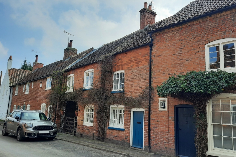
2 cottages, now one dwelling. Late C18. Raised and altered mid C19 and C20. Brick with pantile roof. Single ridge stack. Windows have segmental heads. 2 storeys; 3 window range. Front has a central glazing bar casement flanked by single similar casements, that to right at a lower level, that to left without glazing bars. Below, central blocked doorway with moulded brick surround, containing a Yorkshire sash. To its right, a similar sash and a close boarded door with segmental head and keystone. To left, a carriage entry with wooden lintel. Included for group value.
Listing NGR: SK6912853663
External links are from the relevant listing authority and, where applicable, Wikidata. Wikidata IDs may be related buildings as well as this specific building. If you want to add or update a link, you will need to do so by editing the Wikidata entry.


Other nearby listed buildings