Latitude: 53.3089 / 53°18'32"N
Longitude: -2.0825 / 2°4'57"W
OS Eastings: 394599
OS Northings: 379109
OS Grid: SJ945791
Mapcode National: GBR FZW5.YK
Mapcode Global: WHBBH.Z3H5
Plus Code: 9C5V8W58+HX
Entry Name: Pott Hall
Listing Date: 17 November 1983
Grade: II
Source: Historic England
Source ID: 1277235
English Heritage Legacy ID: 407437
ID on this website: 101277235
Location: Pott Shrigley, Cheshire East, Cheshire, SK10
County: Cheshire East
Civil Parish: Pott Shrigley
Traditional County: Cheshire
Lieutenancy Area (Ceremonial County): Cheshire
Church of England Parish: Pott Shrigley St Christopher
Church of England Diocese: Chester
Tagged with: House
SJ 97 NW POTT SHRIGLEY C.P. SHRIGLEY ROAD (East Side)
5/95 Pott Hall
II
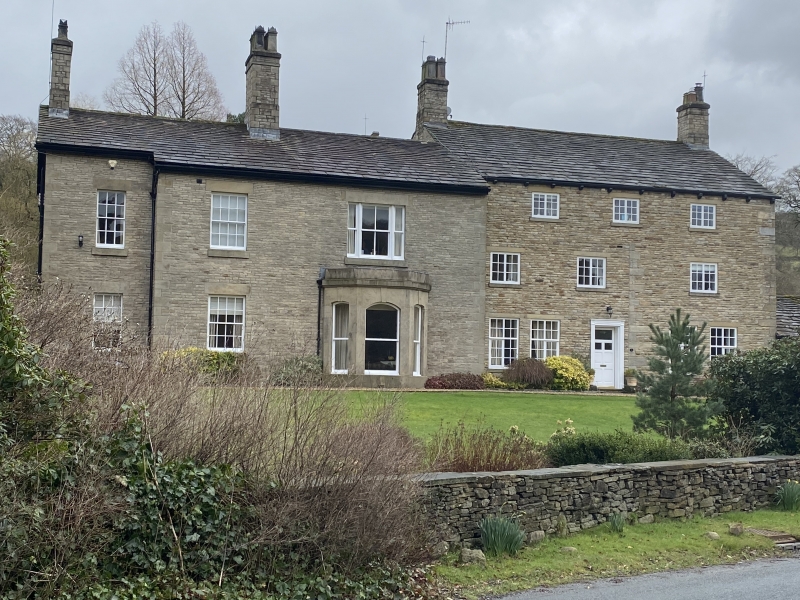
Farmhouse: Probably late C16 origins, late C17 core, mid C18 (perhaps 1743) remodelling and wings of C.1860 and 1878. Coursed sandstone rubble with Kerridge stone-slate roof and massive stacks in right gable end and centre of house. Originally L-shaped, timber-framed house with walls replaced in stone, then C18 infill and outshut. 2 parallel C19 wings to left. 3-storey, 3-bay facade with C18 2-bay infill to left and added upper storey. Right end bay shows 2-storey C17 masonry with paired, wooden, splayed mullion and transomed windows in ground floor. Similar paired casements in left end bay and single 2-light casements with glazing bars throughout upper storeys. Central doorcase with wooden, earred architrave surrounding plain, rectangular fanlight and 6-panelled door. 3-bay C19 wing to left . Interior: Timber small-framing of rear wall and close-studded partition from original house visible in stairwell. Massive bevelled sandstone fireplace now in centre of house. Rooms in core have chamfered beams with tongue stops. Mid C18 fire, cast-iron basket grates (one with "Delft" tile surround) in main rooms and a crude, stone fire surround with Ionic pilasters upstairs. Roof tie beam has graffito RBN 43 M which may date C18 alterations.
Listing NGR: SJ9459679106
External links are from the relevant listing authority and, where applicable, Wikidata. Wikidata IDs may be related buildings as well as this specific building. If you want to add or update a link, you will need to do so by editing the Wikidata entry.


Other nearby listed buildings