Latitude: 53.3099 / 53°18'35"N
Longitude: -2.0842 / 2°5'3"W
OS Eastings: 394488
OS Northings: 379222
OS Grid: SJ944792
Mapcode National: GBR FZW5.L6
Mapcode Global: WHBBH.Y2QC
Plus Code: 9C5V8W58+X8
Entry Name: The School
Listing Date: 17 November 1983
Grade: II
Source: Historic England
Source ID: 1232117
English Heritage Legacy ID: 407438
ID on this website: 101232117
Location: Pott Shrigley, Cheshire East, Cheshire, SK10
County: Cheshire East
Civil Parish: Pott Shrigley
Traditional County: Cheshire
Lieutenancy Area (Ceremonial County): Cheshire
Church of England Parish: Pott Shrigley St Christopher
Church of England Diocese: Chester
Tagged with: School building
SJ 97 NW POTT SHRIGLEY C.P. SHRIGLEY ROAD (East Side)
5/96 The School
GV II
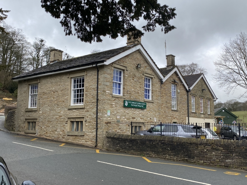
School: c.1861, restored and extended 1967: Coursed sandstone rubble walls with buff sandstone dressings, Kerridge stone-slate roof with plain barge boards and 4 brick chimneys. Double pile under parallel ridge roof. Street front, one storey over basement, symmetrical 2 bay. Basement windows 3-light mullioned windows under hood moulds. Above, large sash windows with glazing bars and coloured glass borders in plain surrounds under hood-moulds. Similar windows and a door in plain stone surround in both sides.
Listed for group value only.
Listing NGR: SJ9448879222
External links are from the relevant listing authority and, where applicable, Wikidata. Wikidata IDs may be related buildings as well as this specific building. If you want to add or update a link, you will need to do so by editing the Wikidata entry.


Other nearby listed buildings