Latitude: 53.3696 / 53°22'10"N
Longitude: -1.0571 / 1°3'25"W
OS Eastings: 462834
OS Northings: 386268
OS Grid: SK628862
Mapcode National: GBR PY1G.YT
Mapcode Global: WHFG0.QKTP
Plus Code: 9C5W9W9V+R5
Entry Name: Spital House
Listing Date: 30 November 1966
Last Amended: 27 November 1984
Grade: II
Source: Historic England
Source ID: 1273871
English Heritage Legacy ID: 416665
ID on this website: 101273871
Location: Blyth, Bassetlaw, Nottinghamshire, S81
County: Nottinghamshire
District: Bassetlaw
Civil Parish: Blyth
Built-Up Area: Blyth
Traditional County: Nottinghamshire
Lieutenancy Area (Ceremonial County): Nottinghamshire
Church of England Parish: Blyth
Church of England Diocese: Southwell and Nottingham
Tagged with: House
SK 68 NW BLYTH SPITAL ROAD (west side)
2/67 spital House (Formerly listed 30.11.66 as Blyth Spital 1 Farmhouse)
G.V. II
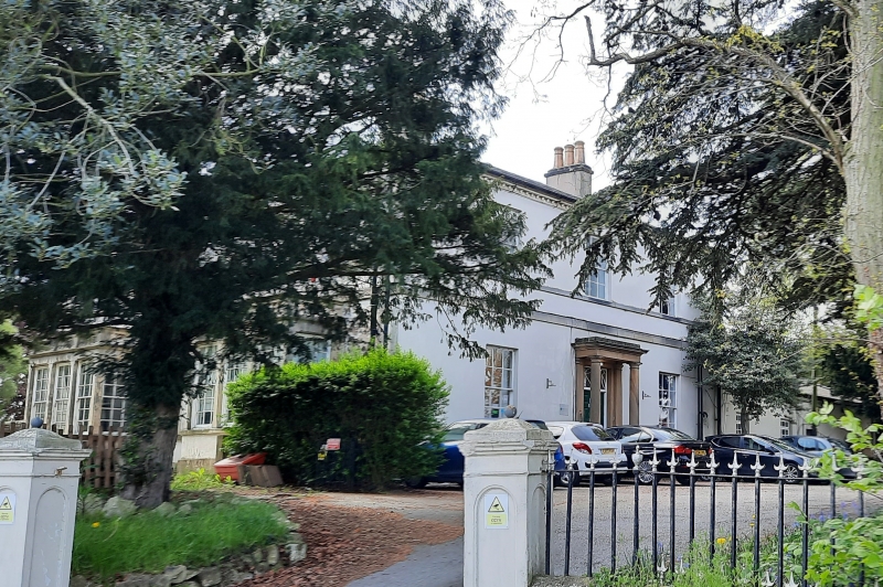
House. Early C19. Ashlar. Hipped slate roof with 2 rendered ridge stacks and modillion cornice. Set on a plinth. 2 storeys, 3 bays wth ground and 1st floor sill bands and 1st floor band. Central doorway with porch, comprising panelled door with traceried overlight flanked by single pilasters with flat modillion decorated projecting hood over, supported on Doric columns. There is a C20 iron hand-rail. Either side single glazing bar sashes, with 3 similar sashes above. The east front of 5 bays has a central glazing bar sash flanked by single protruding window bays topped with an ashlar balustrade. Above are 5 glazing bar sashes. Interior, possibly by Lindley and Woodhead, has a 2 flight return staircase with iron balustrade, having 2 wrought iron balusters decorated with 2 small roundels per tread. The fireplace is decorated with figurative, beaten metal panels.
Listing NGR: SK6283486268
External links are from the relevant listing authority and, where applicable, Wikidata. Wikidata IDs may be related buildings as well as this specific building. If you want to add or update a link, you will need to do so by editing the Wikidata entry.


Other nearby listed buildings