Latitude: 53.3754 / 53°22'31"N
Longitude: -1.0613 / 1°3'40"W
OS Eastings: 462543
OS Northings: 386913
OS Grid: SK625869
Mapcode National: GBR PY1D.0R
Mapcode Global: WHFG0.NFS6
Plus Code: 9C5W9WGQ+5F
Entry Name: Park Farm House
Listing Date: 30 November 1966
Last Amended: 27 November 1984
Grade: II
Source: Historic England
Source ID: 1045125
English Heritage Legacy ID: 241076
ID on this website: 101045125
Location: Blyth, Bassetlaw, Nottinghamshire, S81
County: Nottinghamshire
District: Bassetlaw
Civil Parish: Blyth
Built-Up Area: Blyth
Traditional County: Nottinghamshire
Lieutenancy Area (Ceremonial County): Nottinghamshire
Church of England Parish: Blyth
Church of England Diocese: Southwell and Nottingham
Tagged with: Farmhouse
SK 68 NW BLYTH HIGH STREET (west side)
2/48 Park Farm House [Formerly listed as 30.11.66 Park Farmhouse (house next N of Parish Room)]
G.V. II
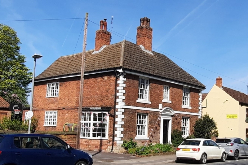
House. C17, altered early C18. Red brick on a coursed rubble plinth with chamfered aslar quoins. Hipped roof with concrete pantiles and single central brick ridge stack. Wooden moulded cornice. 2 storeys, 3 bays, with 1st floor ashlar band. Central doorway, panelled door with painted bolection moulded ashlar surround and segmental pediment. Flanked by single glazing bar sashes with 3 similar sashes above, the central one being smaller.
Listing NGR: SK6254086912
External links are from the relevant listing authority and, where applicable, Wikidata. Wikidata IDs may be related buildings as well as this specific building. If you want to add or update a link, you will need to do so by editing the Wikidata entry.


Other nearby listed buildings