Latitude: 53.1057 / 53°6'20"N
Longitude: -2.0266 / 2°1'35"W
OS Eastings: 398318
OS Northings: 356505
OS Grid: SJ983565
Mapcode National: GBR 24P.BFQ
Mapcode Global: WHBCH.V64D
Plus Code: 9C5V4X4F+79
Entry Name: 19, St Edwards Street
Listing Date: 7 June 1972
Grade: II
Source: Historic England
Source ID: 1268559
English Heritage Legacy ID: 461683
ID on this website: 101268559
Location: Leek, Staffordshire Moorlands, Staffordshire, ST13
County: Staffordshire
District: Staffordshire Moorlands
Civil Parish: Leek
Built-Up Area: Leek
Traditional County: Staffordshire
Lieutenancy Area (Ceremonial County): Staffordshire
Church of England Parish: Leek St Edward the Confessor
Church of England Diocese: Lichfield
Tagged with: Building
LEEK
SJ9856NW ST EDWARD STREET 611-1/4/107 (East side) 07/06/72 No.19
GV II
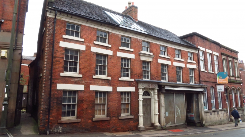
House, now in partial use as shop, the rest disused. Late C18. Brick with plain-tiled roof. EXTERIOR: 3 storeys, 7-window range with central entrance. 6-panelled door with fluted frieze and radial fanlight in highly enriched composite case: Corinthian capitals to fluted columns, twisted in the centre; swagged cornice, and open pediment. Inserted late C19 shop front to right of doorway, with heavy brackets to fascia, and recessed off-centre doorway. Other windows all 12-pane sashes with painted stone cills and lintels. The central window on the first floor has fluted lintel and cornice. 9-pane sashes to attic storey. Moulded stone fluted eaves cornice. End wall and axial stacks. Coped gable to left. INTERIOR: not inspected. The building incorporates a sandstone block wall in the upper gable return, and there is reputed to be similar stonework to the rear.
Listing NGR: SJ9831856505
External links are from the relevant listing authority and, where applicable, Wikidata. Wikidata IDs may be related buildings as well as this specific building. If you want to add or update a link, you will need to do so by editing the Wikidata entry.


Other nearby listed buildings