Latitude: 51.3317 / 51°19'54"N
Longitude: 1.3154 / 1°18'55"E
OS Eastings: 631054
OS Northings: 164395
OS Grid: TR310643
Mapcode National: GBR X0G.HDD
Mapcode Global: VHLGC.RS8H
Plus Code: 9F3388J8+M5
Entry Name: Inglewood
Listing Date: 20 December 1977
Grade: II
Source: Historic England
Source ID: 1267113
English Heritage Legacy ID: 419694
ID on this website: 101267113
Location: Durlock, Thanet, Kent, CT12
County: Kent
District: Thanet
Civil Parish: Minster
Built-Up Area: Minster (Thanet)
Traditional County: Kent
Lieutenancy Area (Ceremonial County): Kent
Tagged with: Building
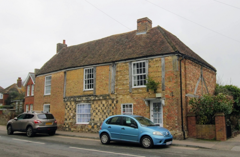
MINSTER HIGH STREET TR 3064-3164 (East Side) 5/29 No. 3/5 (Inglewood) 20-12-77 GV II House. C16, reclad and extended C18. Timber framed and clad with brown bricks with some applied timber, part with flint and ashlar chequer, and exposed on right return with brick infill. Plain tiled roof. Two storeys on uneven and discontinuous plinth, with plat band over central ground floor section of chequerwork - the ashlar re-used medieval tooled stone. Roof hipped to right and with kneelered gable to left; stacks to end left and centre right. Three glazing bar sashes on first floor, and 4 on ground floor, the central one (in the chequerswork section) segmental headed and much larger. The end left bay is a later (ie C18) addition. Entry in left return by rib and stud door with cornice on pilaster surround.
Listing NGR: TR3105864389
External links are from the relevant listing authority and, where applicable, Wikidata. Wikidata IDs may be related buildings as well as this specific building. If you want to add or update a link, you will need to do so by editing the Wikidata entry.


Other nearby listed buildings