Latitude: 51.3309 / 51°19'51"N
Longitude: 1.316 / 1°18'57"E
OS Eastings: 631097
OS Northings: 164308
OS Grid: TR310643
Mapcode National: GBR X0G.HK2
Mapcode Global: VHLGC.RTK3
Plus Code: 9F3388J8+99
Entry Name: The Old School
Listing Date: 7 October 1986
Grade: II
Source: Historic England
Source ID: 1223814
English Heritage Legacy ID: 419686
ID on this website: 101223814
Location: Durlock, Thanet, Kent, CT12
County: Kent
District: Thanet
Civil Parish: Minster
Built-Up Area: Minster (Thanet)
Traditional County: Kent
Lieutenancy Area (Ceremonial County): Kent
Tagged with: School building
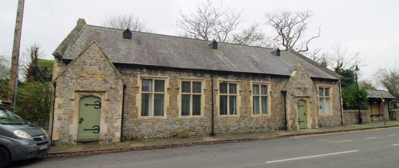
MINSTER CHURCH STREET TR 3064-3164 (South Side) 5/20 The Old School GV II School, now church hall. 1847 and extended 1854. Coursed rubble and slated roof. One storey and attic with kneelered gables and 3 small blocked gable dormers. Stacks projecting at end right, and corbelled out at end left. Five stone mullioned and transomed windows with labels, and projecting and gabled doorways at end left and to right, with four centred arched surrounds, and boarded doors with crescent and strap hinges. Scrolls over doors, to left: Girls; to right: Boys. Interior: altered to accommodate hall.
Listing NGR: TR3109164308
External links are from the relevant listing authority and, where applicable, Wikidata. Wikidata IDs may be related buildings as well as this specific building. If you want to add or update a link, you will need to do so by editing the Wikidata entry.


Other nearby listed buildings