Latitude: 51.3399 / 51°20'23"N
Longitude: 1.2429 / 1°14'34"E
OS Eastings: 625960
OS Northings: 165086
OS Grid: TR259650
Mapcode National: GBR VYV.WKN
Mapcode Global: VHLGB.HLF5
Plus Code: 9F3386QV+X4
Entry Name: Mill Shop
Listing Date: 9 February 1990
Grade: II
Source: Historic England
Source ID: 1266227
English Heritage Legacy ID: 422157
ID on this website: 101266227
Location: Sarre, Thanet, Kent, CT7
County: Kent
District: Thanet
Civil Parish: Sarre
Traditional County: Kent
Lieutenancy Area (Ceremonial County): Kent
Tagged with: Architectural structure
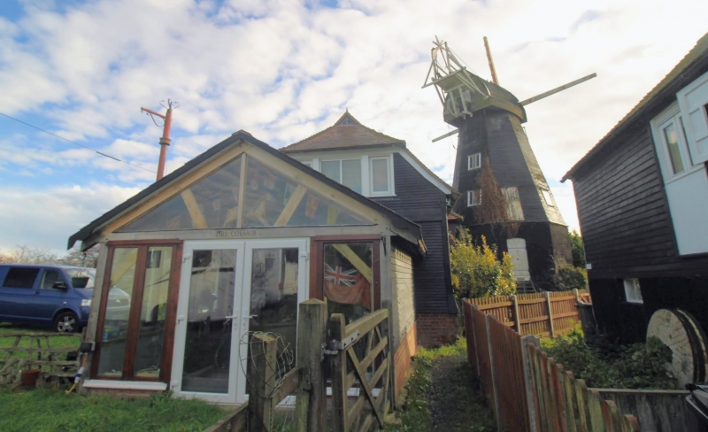
SARRE CANTERBURY ROAD TR 26 NE 1/131 Mill Shop (formerly Granary to Sarre Windmill) GV II Former granary, now in use as mill shop,Late C18 or early C19, possibly predating the windmill which was erected in 1820 and incorporating remains of whips to the sails of an earlier windmill on the site. Ground floor tarred brick, 1st floor weatherboarded (at one time tarred). Hipped old tiled roof. Front facing mill has left side 1st floor plank door with ladder. Right side has early C19 plank door. Side has 1st floor plank door. Ground floor has 2 rectangular openings blocked in with plywood on the outside but retaining iron bars inside. One retains original shutters. Interior has exposed spine beam and floor joists to ground floor and remains of grain shutes. 1st floor has 2 jeweled posts with C18 curved profile, diagonal braces to wall plate, pegged roof with purlins of ridge piece and remains of grain bins. The winch to the sack hoist remains. Attached to the rear is a former stable re-roofed in corrugated iron in the C20 and a C20 lean-to not of special interest.
Listing NGR: TR2561165036
External links are from the relevant listing authority and, where applicable, Wikidata. Wikidata IDs may be related buildings as well as this specific building. If you want to add or update a link, you will need to do so by editing the Wikidata entry.


Other nearby listed buildings