Latitude: 51.3398 / 51°20'23"N
Longitude: 1.243 / 1°14'34"E
OS Eastings: 625966
OS Northings: 165076
OS Grid: TR259650
Mapcode National: GBR VYV.WLZ
Mapcode Global: VHLGB.HLG7
Plus Code: 9F3386QV+W5
Entry Name: Sarre Mill
Listing Date: 11 October 1963
Last Amended: 7 October 1986
Grade: II
Source: Historic England
Source ID: 1225147
English Heritage Legacy ID: 421289
ID on this website: 101225147
Location: Sarre, Thanet, Kent, CT7
County: Kent
District: Thanet
Civil Parish: Sarre
Traditional County: Kent
Lieutenancy Area (Ceremonial County): Kent
Tagged with: Smock mill
SARRE CANTERBURY ROAD TR 26 NE (south side) 1/115 Sarre Mill (formerly listed 11-10-63 as Wind Mill) GV II
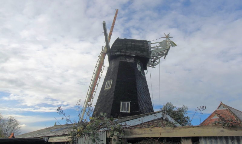
Windmill. 1820 for John Holman of Canterbury, heightened 1856 for Thomas Holman. Timber framed and weather boarded on tarred brown brick base. Octagonal plan, of smockmill type. Gambrel-roofed cap. Sweeps and fantail missing (removed to Cranbrook). Boarded doors to north and south with flights of wooden stairs. Being restored at time of re-survey.
Listing NGR: TR2595665080
External links are from the relevant listing authority and, where applicable, Wikidata. Wikidata IDs may be related buildings as well as this specific building. If you want to add or update a link, you will need to do so by editing the Wikidata entry.


Other nearby listed buildings