Latitude: 53.9635 / 53°57'48"N
Longitude: -1.0773 / 1°4'38"W
OS Eastings: 460630
OS Northings: 452333
OS Grid: SE606523
Mapcode National: GBR NQXL.KX
Mapcode Global: WHFC3.FM6V
Plus Code: 9C5WXW7F+C3
Entry Name: 19 and 21, Monkgate
Listing Date: 14 June 1954
Grade: II
Source: Historic England
Source ID: 1257240
English Heritage Legacy ID: 464112
ID on this website: 101257240
Location: The Groves, York, North Yorkshire, YO31
County: York
Electoral Ward/Division: Guildhall
Parish: Non Civil Parish
Built-Up Area: York
Traditional County: Yorkshire
Lieutenancy Area (Ceremonial County): North Yorkshire
Church of England Parish: York St Thomas with St Maurice
Church of England Diocese: York
Tagged with: Building
YORK
SE6052SE MONKGATE 1112-1/14/728 (North West side) 14/06/54 Nos.19 AND 21
GV II
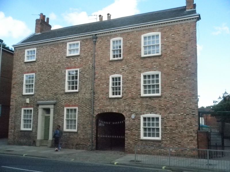
Two houses, now flats. Dated 1812; extensively restored 1984. Brick with slate roof. EXTERIOR: 3 storeys and 4 bays. The windows are glazing bar sashes. The 1st and 2nd floor windows of the 2 left-hand bays have rubbed brick flat arches. The windows to the 2 right-hand bays are slightly lower and have segmental brick heads. On the ground floor the 3rd bay contains a carriageway with an elliptical brick arch. The doorway, between the 1st and 2nd bays, has a plain pilaster doorcase with panelled reveals, a divided rectangular overlight, and a door with 6 raised and fielded panels. The gutter cornice is dentilled and modillioned. Between the 2nd and 3rd bays there is a lead rainwater hopper inscribed 'TS 1812'. Gable chimneys. INTERIOR: not inspected. (An Inventory of the Historical Monuments of the City of York: RCHME: Outside the City Walls East of the Ouse: HMSO: 1975-: 87-8).
Listing NGR: SE6063052333
External links are from the relevant listing authority and, where applicable, Wikidata. Wikidata IDs may be related buildings as well as this specific building. If you want to add or update a link, you will need to do so by editing the Wikidata entry.


Other nearby listed buildings