Latitude: 53.9637 / 53°57'49"N
Longitude: -1.0761 / 1°4'34"W
OS Eastings: 460710
OS Northings: 452354
OS Grid: SE607523
Mapcode National: GBR NQXL.TV
Mapcode Global: WHFC3.FMSQ
Plus Code: 9C5WXW7F+FH
Entry Name: 40, Monkgate
Listing Date: 14 June 1954
Grade: II
Source: Historic England
Source ID: 1257210
English Heritage Legacy ID: 464124
ID on this website: 101257210
Location: The Groves, York, North Yorkshire, YO31
County: York
Electoral Ward/Division: Guildhall
Parish: Non Civil Parish
Built-Up Area: York
Traditional County: Yorkshire
Lieutenancy Area (Ceremonial County): North Yorkshire
Church of England Parish: York St Michael-le-Belfrey
Church of England Diocese: York
Tagged with: Building
YORK
SE6052SE MONKGATE 1112-1/14/737 (South East side) 14/06/54 No.40
GV II
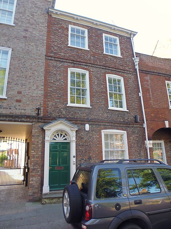
House, now office. Early C18 with alterations of c1800. Brick in Flemish bond with red brick to each side of facade and to window surrounds. Slate roof. EXTERIOR: 3 storeys and 2 bays. Facade has 2 string courses, and a timber cornice gutter carried on paired brackets. The windows are sashed with glazing bars and segmental arched heads. To the left of the ground-floor window there is a Tuscan pilaster doorcase with medallions over the caps and with a fanlight within an open dentilled pediment. The door has 6 raised and fielded panels. Chimneys at right and behind ridge. INTERIOR: RCHM records original open string staircase with turned balusters with square knops. (An Inventory of the Historical Monuments of the City of York: RCHME: Outside the City Walls East of the Ouse: HMSO: 1975-: 90).
Listing NGR: SE6072152361
External links are from the relevant listing authority and, where applicable, Wikidata. Wikidata IDs may be related buildings as well as this specific building. If you want to add or update a link, you will need to do so by editing the Wikidata entry.


Other nearby listed buildings