Latitude: 51.2572 / 51°15'25"N
Longitude: 1.3498 / 1°20'59"E
OS Eastings: 633823
OS Northings: 156222
OS Grid: TR338562
Mapcode National: GBR X1H.02V
Mapcode Global: VHLGS.BNXM
Plus Code: 9F33784X+VW
Entry Name: Corner Cottage
Listing Date: 15 April 1980
Grade: II
Source: Historic England
Source ID: 1247855
English Heritage Legacy ID: 429258
ID on this website: 101247855
Location: Worth, Dover, Kent, CT14
County: Kent
District: Dover
Civil Parish: Worth
Built-Up Area: Worth
Traditional County: Kent
Lieutenancy Area (Ceremonial County): Kent
Tagged with: Cottage
WORTH THE STREET TR 35 NW (South side)
1/161
15.4.80 Corner Cottage
II
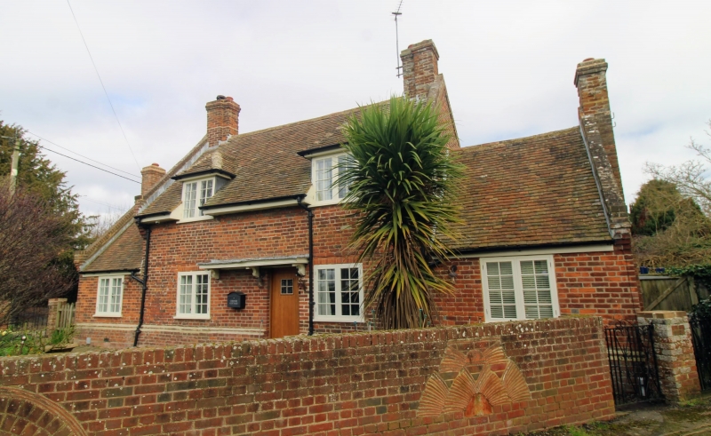
House. Dated 1675 and altered and extended late C19. Red brick and plain tiled roof. One storey and attic central block on weathered plinth with kneelered gables with 2 hipped dormers and stacks to left and to right, with 1 storey flanking wings, also with parapet gables. Four wooden casements and boarded door to centre right under double width flat hood on brackets. Interior: stop chamfered beams, and post carved with date 1675.
Listing NGR: TR3382356222
External links are from the relevant listing authority and, where applicable, Wikidata. Wikidata IDs may be related buildings as well as this specific building. If you want to add or update a link, you will need to do so by editing the Wikidata entry.


Other nearby listed buildings