Latitude: 51.2567 / 51°15'24"N
Longitude: 1.3477 / 1°20'51"E
OS Eastings: 633684
OS Northings: 156160
OS Grid: TR336561
Mapcode National: GBR X1G.5K9
Mapcode Global: VHLGS.9NVZ
Plus Code: 9F33784X+M3
Entry Name: Barton Farmhouse
Listing Date: 11 October 1963
Grade: II
Source: Historic England
Source ID: 1247853
English Heritage Legacy ID: 429254
ID on this website: 101247853
Location: Worth, Dover, Kent, CT14
County: Kent
District: Dover
Civil Parish: Worth
Built-Up Area: Worth
Traditional County: Kent
Lieutenancy Area (Ceremonial County): Kent
Tagged with: Farmhouse
WORTH THE STREET TR 35 NW (North side)
1/157 Barton Farmhouse
11.10.63
GV II
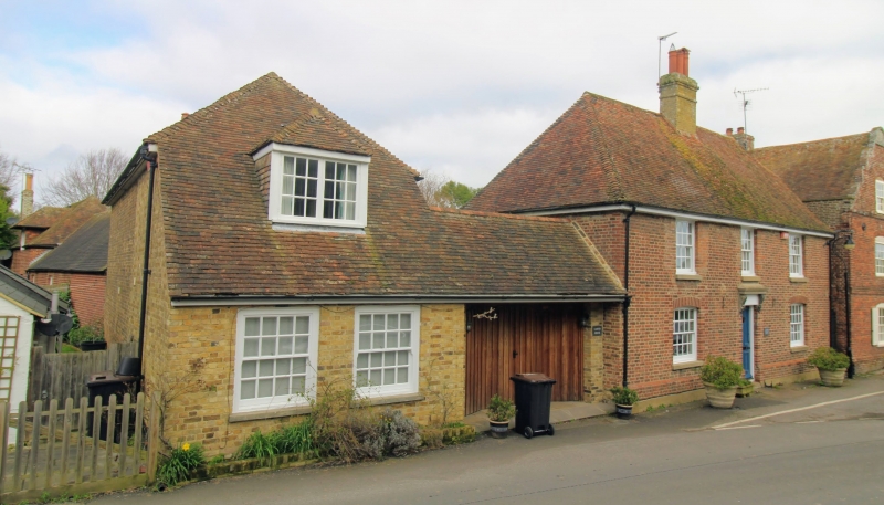
House. Late C17 altered early C20. Red brick and plain tiled roof. Two storeys and attic on plinth with boxed eaves to roof with segmental Dutch gable to left and half-hipped roof to right, with 4 hipped dormers inserted early C20, and stack to centre left. Four glazing bar sashes on first floor and 3 on ground floor with segmental heads. Central glazed door, the doorway original 1 bay to left, the pilastered doorcase now missing. Single storey with attic, extension to right with glazed door and early C19 shop front with large glazing bar sashes. Interior: inglenook, large scantling chamfered ceiling joists.
Listing NGR: TR3368456160
External links are from the relevant listing authority and, where applicable, Wikidata. Wikidata IDs may be related buildings as well as this specific building. If you want to add or update a link, you will need to do so by editing the Wikidata entry.


Other nearby listed buildings