Latitude: 51.8602 / 51°51'36"N
Longitude: -2.2573 / 2°15'26"W
OS Eastings: 382379
OS Northings: 217985
OS Grid: SO823179
Mapcode National: GBR 1L5.655
Mapcode Global: VH94B.THJV
Plus Code: 9C3VVP6V+33
Entry Name: Llanthony Priory Farmhouse
Listing Date: 23 January 1952
Last Amended: 15 December 1998
Grade: II
Source: Historic England
Source ID: 1245765
English Heritage Legacy ID: 472286
ID on this website: 101245765
Location: High Orchard, Gloucester, Gloucestershire, GL2
County: Gloucestershire
District: Gloucester
Electoral Ward/Division: Westgate
Parish: Non Civil Parish
Built-Up Area: Gloucester
Traditional County: Gloucestershire
Lieutenancy Area (Ceremonial County): Gloucestershire
Church of England Parish: Hempsted with Gloucester, Saint Mary de Lode and Saint Mary de Crypt
Church of England Diocese: Gloucester
Tagged with: Farmhouse
GLOUCESTER
SO8217 LLANTHONY ROAD 844-1/15/155 (East side) 23/01/52 Llanthony Priory Farmhouse (Formerly Listed as: HEMPSTED LANE Remains of Llanthony Priory)
GV II
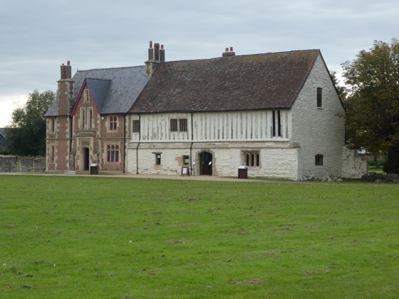
Farmhouse, now storehouse. c1870-80 on site and incorporating some remains of the south end (a former gatehouse) of the former C14 range of monastic buildings between the Outer and Inner Courts of the Augustinian Priory of Llanthony Secunda. Built of red brick with patterned blue headers and limestone ashlar dressings; slate roof with brick stacks. Tudor Gothic style. Double-depth block. EXTERIOR: two storeys. 3-bay east elevation, the centre gabled and broken forward with blind trefoiled light to apex; 2 trefoiled lancets in square-headed architrave to first floor; offset buttresses flank projecting porch with labelmould over hollow-chamfered ogee-headed doorway with 4 similar ogee arches to overlight; labelmould over lancet in square-headed architrave to left, Caernarvon-arched architrave in square-headed architrave above; these patterns repeated in 2-light transomed first-floor window and 3-light ground-floor window to right with plate-glass sashes. Similar detail to other elevations, the west elevation being articulated by offset stack and gable. INTERIOR: not inspected. This building dates from the use of the site as a farm, from the Dissolution until the late C19.
Listing NGR: SO8237917984
External links are from the relevant listing authority and, where applicable, Wikidata. Wikidata IDs may be related buildings as well as this specific building. If you want to add or update a link, you will need to do so by editing the Wikidata entry.


Other nearby listed buildings