Latitude: 51.3633 / 51°21'47"N
Longitude: -2.0317 / 2°1'54"W
OS Eastings: 397886
OS Northings: 162696
OS Grid: ST978626
Mapcode National: GBR 2TS.H4T
Mapcode Global: VHB47.QZRR
Plus Code: 9C3V9X79+88
Entry Name: The Jacobean House
Listing Date: 3 April 1987
Grade: II
Source: Historic England
Source ID: 1243479
English Heritage Legacy ID: 447348
ID on this website: 101243479
Location: Rowde, Wiltshire, SN10
County: Wiltshire
Civil Parish: Rowde
Built-Up Area: Rowde
Traditional County: Wiltshire
Lieutenancy Area (Ceremonial County): Wiltshire
Tagged with: House
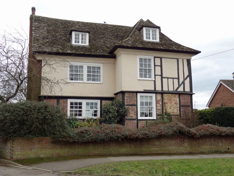
ROWDE HIGH STREET ST 9762 (south side) 11/241 The Jacobean House II House, late C17 or early C18 rebuilding of early C17 timber-framed house, the west end of the demolished Lamb Inn. Timber frame with some render and steep stone slate roof. Two storeys and attic, deep coved eaves cornice, timber-frame and brick ground floor, rendered first floor with some exposed framing. To right, hipped- roof 2-window section with 12-pane sashes to left and blocked openings to right, and one hipped dormer. Slightly set-back to left, 2-window range with one hipped dormer, coved cornice and renewed 12-pane sashes. C20 red brick east end wall and rear wall. West front has roof slope stack, coved cornice, 2 first floor 12-pane sashes and ground floor 12-pane sash, door in C20 porch and 2 casements. Lean-to on south end. Interior: closed string staircase with turned balusters and square newels. Large moulded stone C17 fireplace and stone shelf to drawing room. Dining room with early C18 panelling and bolection- moulded corner fireplace. (Wiltshire Buildings Record)
Listing NGR: ST9788662696
External links are from the relevant listing authority and, where applicable, Wikidata. Wikidata IDs may be related buildings as well as this specific building. If you want to add or update a link, you will need to do so by editing the Wikidata entry.


Other nearby listed buildings