Latitude: 50.9908 / 50°59'26"N
Longitude: 0.9475 / 0°56'51"E
OS Eastings: 606950
OS Northings: 125398
OS Grid: TR069253
Mapcode National: GBR T02.SGD
Mapcode Global: FRA D6WH.DYV
Plus Code: 9F22XWRX+82
Entry Name: Brissenden
Listing Date: 26 January 1995
Grade: II
Source: Historic England
Source ID: 1240238
English Heritage Legacy ID: 438368
ID on this website: 101240238
Location: New Romney, Folkestone and Hythe, Kent, TN28
County: Kent
District: Folkestone and Hythe
Civil Parish: New Romney
Built-Up Area: New Romney
Traditional County: Kent
Lieutenancy Area (Ceremonial County): Kent
Tagged with: Building
TR02NE NEW ROMNEY DYMCHURCH ROAD
3/10002 Brissenden
- II
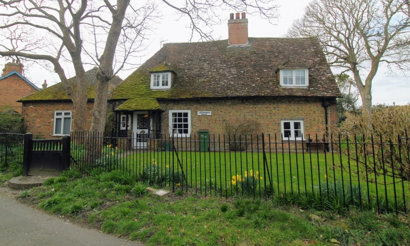
House, at one time 2 cottages. South west range C17, refronted in early C19. North west range early C19. South west range of one storey and attics; 2 windows. Red brick with tiled roof, half-hipped to left and gabled to right, with central chimneystack. Two hipped dormers and 12-pane sashes. North west range of 2 storeys; 2 windows. Tiled roof with end brick chimneystack. Twelve pane sashes with horns, cambered to ground floor. Interior has open fireplaces with wooden bressumers, exposed floor joists and plank doors.
Listing NGR: TR0695025398
External links are from the relevant listing authority and, where applicable, Wikidata. Wikidata IDs may be related buildings as well as this specific building. If you want to add or update a link, you will need to do so by editing the Wikidata entry.


Other nearby listed buildings