Latitude: 50.9365 / 50°56'11"N
Longitude: 0.7626 / 0°45'45"E
OS Eastings: 594198
OS Northings: 118860
OS Grid: TQ941188
Mapcode National: GBR RZ8.7LR
Mapcode Global: FRA D6HM.LX1
Plus Code: 9F22WQP7+H2
Entry Name: The Martello Tower
Listing Date: 3 August 1961
Grade: II
Source: Historic England
Source ID: 1234372
English Heritage Legacy ID: 410024
ID on this website: 101234372
Location: Rye Harbour, Rother, East Sussex, TN31
County: East Sussex
District: Rother
Civil Parish: Icklesham
Built-Up Area: Rye Harbour
Traditional County: Sussex
Lieutenancy Area (Ceremonial County): East Sussex
Church of England Parish: Rye
Church of England Diocese: Chichester
TQ 91 NW ICKLESHAM RYE HARBOUR
25/12 The Martello Tower
3.8.61 II
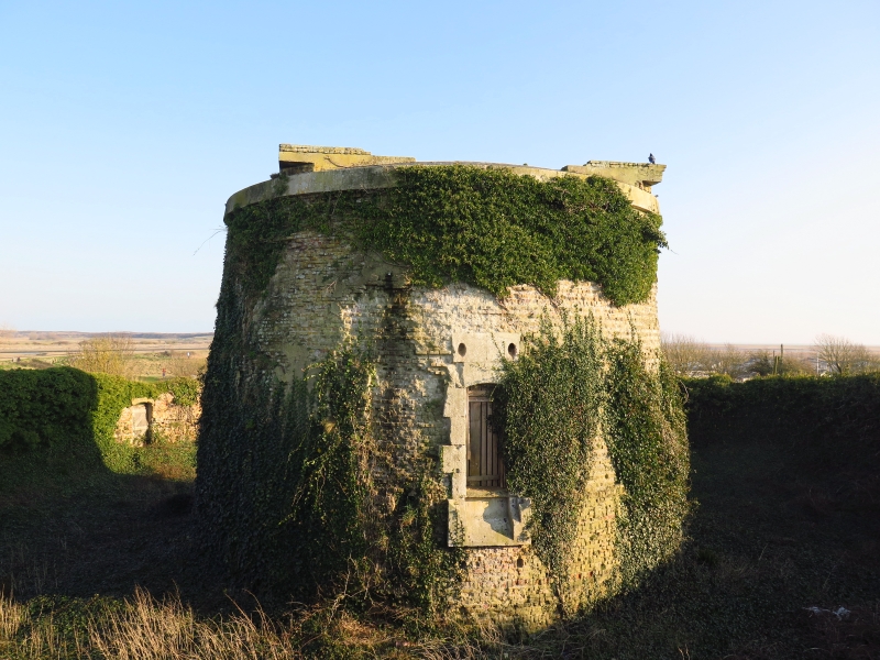
The tower is numbered 28. Circular tower erected for defence purposes during the invasion scare of 1806. Walls built of brick 5½-6 feet thick, covered with a coating of cement (now peeling off). Eaves cornice of cement. the centre of the roof is flat with a sloping portion round the edge. Doorway about 20 fett above the ground. Inside originally a magazine and 2 floors above this. The tower is set in a circle of a red brick wall backed with an earth vallum.
Listing NGR: TQ9419818860


Other nearby listed buildings