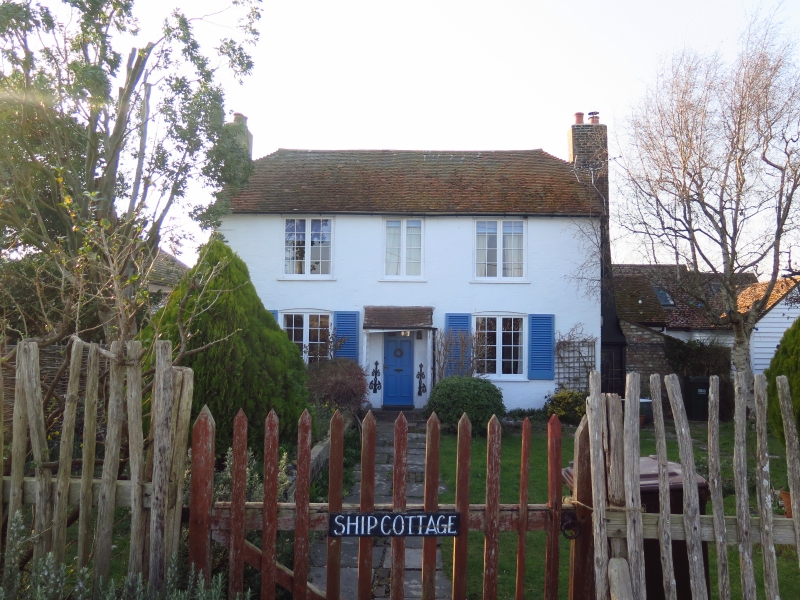
Latitude: 50.9382 / 50°56'17"N
Longitude: 0.7626 / 0°45'45"E
OS Eastings: 594195
OS Northings: 119050
OS Grid: TQ941190
Mapcode National: GBR RZ8.1NB
Mapcode Global: FRA D6HM.DYG
Plus Code: 9F22WQQ7+72
Entry Name: Ship Cottage
Listing Date: 13 May 1987
Grade: II
Source: Historic England
Source ID: 1234190
English Heritage Legacy ID: 410021
ID on this website: 101234190
Location: Rye Harbour, Rother, East Sussex, TN31
County: East Sussex
District: Rother
Civil Parish: Icklesham
Built-Up Area: Rye Harbour
Traditional County: Sussex
Lieutenancy Area (Ceremonial County): East Sussex
Church of England Parish: Rye
Church of England Diocese: Chichester
Tagged with: Cottage
TQ 91 NW ICKLESHAM RYE HARBOUR
25/9 Ship Cottage
GV II
C18. Two storeys. Three windows. Painted brick. Half-hipped tiled roof. Casement windows.
Listing NGR: TQ9419519050
External links are from the relevant listing authority and, where applicable, Wikidata. Wikidata IDs may be related buildings as well as this specific building. If you want to add or update a link, you will need to do so by editing the Wikidata entry.


Other nearby listed buildings