Latitude: 52.6626 / 52°39'45"N
Longitude: 0.1505 / 0°9'1"E
OS Eastings: 545536
OS Northings: 309382
OS Grid: TF455093
Mapcode National: GBR L1X.2VN
Mapcode Global: WHJPH.8BXL
Plus Code: 9F42M572+36
Entry Name: 61, North Brink
Listing Date: 10 February 1969
Grade: II
Source: Historic England
Source ID: 1229503
English Heritage Legacy ID: 48395
ID on this website: 101229503
Location: Wisbech, Fenland, Cambridgeshire, PE13
County: Cambridgeshire
District: Fenland
Civil Parish: Wisbech
Built-Up Area: Wisbech
Traditional County: Cambridgeshire
Lieutenancy Area (Ceremonial County): Cambridgeshire
Church of England Parish: Wisbech St Peter and St Paul
Church of England Diocese: Ely
Tagged with: Building
The following previous listing date shall be added.
Page 82 Item number 7/190 10.2.69
--------------------------------------
WISBECH NORTH BRINK TF 4509 7/190 No. 61 GV II
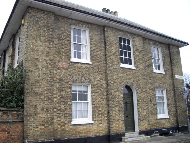
Early C19 house fronting the stables to Sibalds Holme and reputed to be the coachman's house. Yellow gault brick with hipped slate roof and deep boarded eaves. Two stacks. Square plan, two storeys with basement. Street facade facing river. Pilasters at quoins with centre 'bay' slightly projecting. Two first floor hung sash windows in cambered gauged brick arches with stone cills flank central blind window. Similar ground floor windows. Six-panelled door recessed in round-headed brick arch with fanlight. Bricks replace second world war gun positions at first floor level. Interior details good, of particular interest are the shell motifs to each doorcase. Good chimney piece in room to right hand. Reeded details similar to Sibalds Holme. Photographs and prints, C18 and C19, W. & F. Mus.
Listing NGR: TF4553609382
External links are from the relevant listing authority and, where applicable, Wikidata. Wikidata IDs may be related buildings as well as this specific building. If you want to add or update a link, you will need to do so by editing the Wikidata entry.


Other nearby listed buildings