Latitude: 53.0605 / 53°3'37"N
Longitude: -1.1833 / 1°10'59"W
OS Eastings: 454833
OS Northings: 351787
OS Grid: SK548517
Mapcode National: GBR 8GC.1PK
Mapcode Global: WHDGC.SBQK
Plus Code: 9C5W3R68+6M
Entry Name: Stable Range at Papplewick Hall
Listing Date: 13 October 1966
Grade: II
Source: Historic England
Source ID: 1227537
English Heritage Legacy ID: 425385
ID on this website: 101227537
Location: Papplewick, Gedling, Nottinghamshire, NG15
County: Nottinghamshire
District: Gedling
Civil Parish: Papplewick
Traditional County: Nottinghamshire
Lieutenancy Area (Ceremonial County): Nottinghamshire
Church of England Parish: Linby with Papplewick
Church of England Diocese: Southwell and Nottingham
Tagged with: Stable
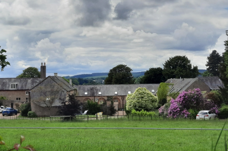
PAPPLEWICK off BLIDWORTH WAYE SK 55 SW Formerly Main Street (west side) 1/122 Stable range at Papplewick Hall 13.10.66 G.V. II Stable range, now houses. Late C18 and early C19. Coursed and squared rubble with gabled and hipped slate roofs. Rubble plinth, plain eaves, 2 ridge stacks. Windows are mainly C18 mullioned casements and unglazed openings. Single and 2 storeys, 6 bays deep by 5 bays wide. C-plan around square courtyard, plus wing to north. Courtyard north side has projecting pedimented central bay with 3 carriage openings with elliptical heads. Flanked by single round headed doorways and beyond, 2 round headed casements. To right again, door and window. West side has 5 recessed round headed openings each with door with fanlight, South side has 3 doors flanked by 2 mullioned casements. Beyond, to left, a casement. Beyond to right, 3 casements. Above, 6 Yorkshire sashes. East side has boundary wall with flat coping. Pair of square gatepiers with moulded bases and corniced capitals. North wing has to east, irregular C20 fenestration. North gable has stone stairway. West side has C20 fenestration. North and west rear elevations have irregular unglazed fenestration.
Listing NGR: SK5483351787
External links are from the relevant listing authority and, where applicable, Wikidata. Wikidata IDs may be related buildings as well as this specific building. If you want to add or update a link, you will need to do so by editing the Wikidata entry.


Other nearby listed buildings