Latitude: 52.5143 / 52°30'51"N
Longitude: -1.6436 / 1°38'37"W
OS Eastings: 424280
OS Northings: 290772
OS Grid: SP242907
Mapcode National: GBR 5JB.C8K
Mapcode Global: VHBWH.G2FC
Plus Code: 9C4WG974+PG
Entry Name: The Old Rectory
Listing Date: 11 November 1952
Last Amended: 23 March 1988
Grade: II
Source: Historic England
Source ID: 1226142
English Heritage Legacy ID: 423267
ID on this website: 101226142
Location: Church End, North Warwickshire, B46
County: Warwickshire
District: North Warwickshire
Civil Parish: Shustoke
Traditional County: Warwickshire
Lieutenancy Area (Ceremonial County): Warwickshire
Church of England Parish: Whitacres, Lea Marston and Shustoke
Church of England Diocese: Birmingham
Tagged with: Clergy house
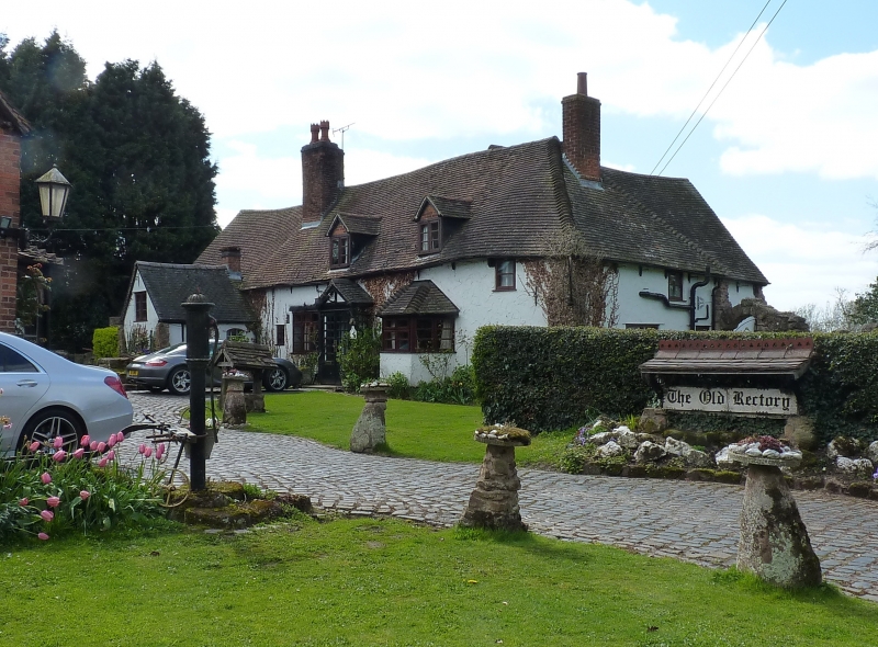
SHUSTOKE SHAWBURY LANE SP2490 (West side) Church End 14/199 The Old Rectory 11/11/52 (Formerly listed as Old Rectory (now cottages)) GV II House. C14 with C17 additions. Cruck built, on sandstone plinth. Rendered walls, C20. Plain-tiled roof hipped at north-west end. Two internal stacks of red brick. Main north-south range with cross-passage away from the hearth and 2 later gabled wings at rear. One storey and attic. 2 modern gable dormers with wood casements. Ground floor has late C20 bow and canted bays on either side of doorway to former cross-passage. Small casement to north end. Modern doorway and door. To south-east end a single storey, C20 extension forms a porch. Interior: Two full cruck roof trusses of the original open-hall house are visible. Both have closed walls. The one at the north end was probably the gable end. The other forms the end wall of the open-hall. Together they are a complete bay of the original house. The purlins are the only members of the roof structure of the original building which provide evidence of the extent of the original house. They extend for at least a further bay which would have been the open-hall. The crucks rest on a sandstone plinth. They are joined by a yoke which is surmounted by a King-post and a ridge piece laid flat. One pair of blades has a rail part of which has been removed to make a doorway. The roof has principal rafters with paired and curved wind bracing. The braces are laid one over the other on the back of the principal rafters and secured by a peg. The purlins are laid over the back of the blade in a shallow trench. They are inclined. A lower spur is also housed over the blade and carries the end of the principal rafter on its upper edge. Apart from a chamfer none of the timbers is moulded. Despite restoration it seems likely that this end bay was floored when built. The King-post is longer than that at the Bothie, Botts Green, Over Whitacre (q.v.). However the yoke is probably not as long as the collar or tie-beam linking the 2 blades of the base cruck at Priory Farmhouse, Bixhill Lane, Shustoke (q.v.). The house was the birth place in 1605 of Sir William Dugdale, the antiquary. (J.T.Smith: Cruck Distributions: An Interpretation of Some Recent Maps (Vernacular Architecture, Vol.6, 1975))
Listing NGR: SP2428090772
External links are from the relevant listing authority and, where applicable, Wikidata. Wikidata IDs may be related buildings as well as this specific building. If you want to add or update a link, you will need to do so by editing the Wikidata entry.


Other nearby listed buildings