Latitude: 51.3404 / 51°20'25"N
Longitude: 1.237 / 1°14'13"E
OS Eastings: 625549
OS Northings: 165122
OS Grid: TR255651
Mapcode National: GBR VYV.TVJ
Mapcode Global: VHLGB.DK9S
Plus Code: 9F3386RP+5R
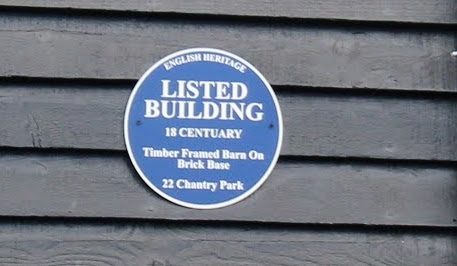
Entry Name: Former Barn at G.G. Baxter's factory
Listing Date: 7 October 1986
Grade: II
Source: Historic England
Source ID: 1225054
English Heritage Legacy ID: 421305
ID on this website: 101225054
Location: Sarre, Thanet, Kent, CT7
County: Kent
District: Thanet
Civil Parish: Sarre
Traditional County: Kent
Lieutenancy Area (Ceremonial County): Kent
Tagged with: Barn
This list entry was subject to a Minor Amendment on 8 December 2025 to update the Name and Address and reformat the text to current standards
TR 26 NE
1/125
SARRE
CHANTRY PARK
Former Barn at G.G. Baxter's factory
(Formerly listed as OLD ROAD (north side) Barn at G.G. Baxter's factory)
GV
II
Barn. C16 and C18. Timber framed on brick base and weather boarded. Corrugated asbestos roof. Half-hipped roof stepped down to lower half-hipped range to left, with hip to right. Hipped mid-strey. Boarded door and shuttered wooden casement to left, and cart doors to right, with remains of C19 oast beyond.
Interior: eight bays with aisles and terminal outshots. The western most bays (in the lower range) are C16, with passing shores to arcade posts, queen struts and staggered purlins. The remaining six bays, although of the same construction, appear to be C18.
Listing NGR: TR2547165089
External links are from the relevant listing authority and, where applicable, Wikidata. Wikidata IDs may be related buildings as well as this specific building. If you want to add or update a link, you will need to do so by editing the Wikidata entry.


Other nearby listed buildings