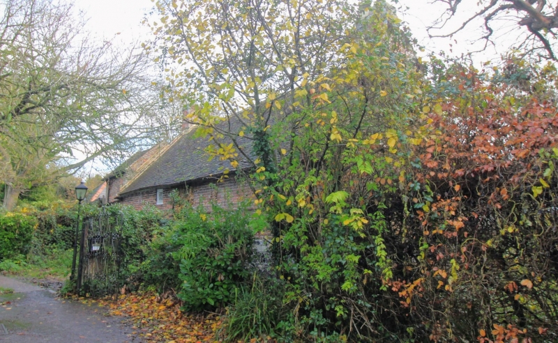
Latitude: 51.3396 / 51°20'22"N
Longitude: 1.2378 / 1°14'16"E
OS Eastings: 625611
OS Northings: 165036
OS Grid: TR256650
Mapcode National: GBR VYV.V3L
Mapcode Global: VHLGB.DLRD
Plus Code: 9F3386QQ+R4
Entry Name: Lambs Cottage
Listing Date: 25 June 1971
Grade: II
Source: Historic England
Source ID: 1225048
English Heritage Legacy ID: 421291
ID on this website: 101225048
Location: Sarre, Thanet, Kent, CT7
County: Kent
District: Thanet
Civil Parish: Sarre
Traditional County: Kent
Lieutenancy Area (Ceremonial County): Kent
Tagged with: Cottage
SARRE CANTERBURY ROAD TR 26 NE (north side) 1/116 25.6.71 Lambs Cottage GV II
House. Dated 1691 and extended early C18. Red brick on flint with plain tiled roof. One storey and attic and extended with 2 storeys to right. Flint plinth, plat band and dogtooth cornice. Shaped segmental gable to left,kneelered gable to right obscured by later extension. Two hipped dormers and stacks to end left right and end right. Irregular fenestration of 1 glazing bar sash to left, 1 horizontally sliding sash and 1 wooden casement and boarded door to left, and 1 wooden casement on each floor to right with boarded door at end right. Left return gable end with alphabetical wall-ties;M W and plaque W M M 1691 Interior: winder stairs around both main stacks; doors and fittings C17 coved and moulded overmantel. Moulded ceiling beams.
Listing NGR: TR2561165036
External links are from the relevant listing authority and, where applicable, Wikidata. Wikidata IDs may be related buildings as well as this specific building. If you want to add or update a link, you will need to do so by editing the Wikidata entry.


Other nearby listed buildings