Latitude: 51.3615 / 51°21'41"N
Longitude: 1.2425 / 1°14'32"E
OS Eastings: 625826
OS Northings: 167481
OS Grid: TR258674
Mapcode National: GBR VYN.NXJ
Mapcode Global: VHLGB.H16M
Plus Code: 9F33966R+HX
Entry Name: Nine Nails
Listing Date: 25 June 1971
Grade: II
Source: Historic England
Source ID: 1224808
English Heritage Legacy ID: 420962
ID on this website: 101224808
Location: Thanet, Kent, CT7
County: Kent
District: Thanet
Civil Parish: St. Nicholas at Wade
Traditional County: Kent
Lieutenancy Area (Ceremonial County): Kent
Tagged with: Architectural structure
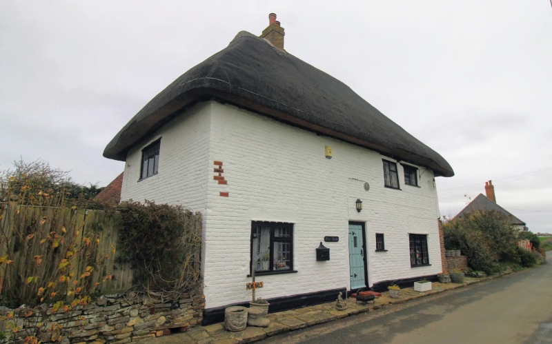
ST NICHOLAS AT WADE POTTEN STREET TR 26 NE (north side) 1/96 Nine Nails 25.6.71 II House. C16. Timber framed, refronted with painted brick, right return roughcast. Thatched and plain tiled roof. Lobby entry plan. Two storeys on plinth with jetty on right return, possibly on dragon posts. Hipped roof with stack cluster to centre left. Two metal casements on first floor, 2 wooden casements on ground floor and half-glazed door to centre left with small sidelights. Catslide outshot to rear.
Listing NGR: TR2582667481
External links are from the relevant listing authority and, where applicable, Wikidata. Wikidata IDs may be related buildings as well as this specific building. If you want to add or update a link, you will need to do so by editing the Wikidata entry.


Other nearby listed buildings