Latitude: 52.3682 / 52°22'5"N
Longitude: -2.7178 / 2°43'4"W
OS Eastings: 351224
OS Northings: 274704
OS Grid: SO512747
Mapcode National: GBR BK.RZJ9
Mapcode Global: VH843.VQ2X
Plus Code: 9C4V979J+7V
Entry Name: 5, Bull Ring
Listing Date: 15 March 1974
Grade: II
Source: Historic England
Source ID: 1219571
English Heritage Legacy ID: 389789
ID on this website: 101219571
LUDLOW
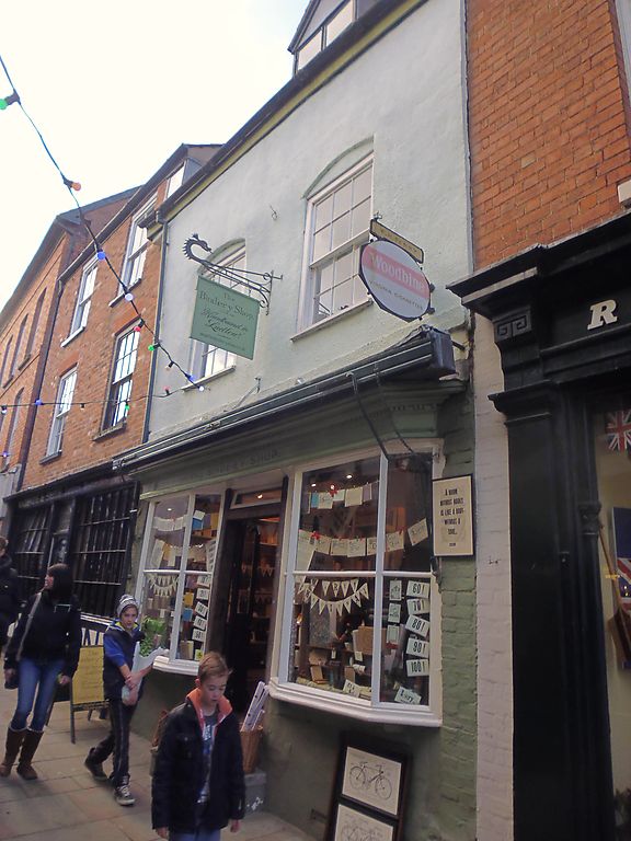
SO5174 BULL RING 825-1/1/165 (West side) 15/03/74 No.5
GV II
Shop and dwelling. C18. Painted roughcast brick; plain tile roof; 2-storeys, attic and cellar; two C20 casements recessed in altered openings; gable dormer with casement. C19 shopfront: 2-panel double-doors in beaded case, with casement overlight; flanked by canted bays with glazing bars, under moulded modillioned awning hood, with storey band over.
Listing NGR: SO5122174704
External links are from the relevant listing authority and, where applicable, Wikidata. Wikidata IDs may be related buildings as well as this specific building. If you want to add or update a link, you will need to do so by editing the Wikidata entry.


Other nearby listed buildings