Latitude: 54.1555 / 54°9'19"N
Longitude: -3.1857 / 3°11'8"W
OS Eastings: 322662
OS Northings: 473949
OS Grid: SD226739
Mapcode National: GBR 6N6D.33
Mapcode Global: WH72B.1T85
Plus Code: 9C6R5R47+6P
Entry Name: 4, Market Place
Listing Date: 6 May 1976
Last Amended: 20 December 1993
Grade: II
Source: Historic England
Source ID: 1218304
English Heritage Legacy ID: 388500
ID on this website: 101218304
Location: Dalton-in-Furness, Westmorland and Furness, Cumbria, LA15
County: Westmorland and Furness
District: Barrow-in-Furness
Civil Parish: Dalton Town with Newton
Built-Up Area: Dalton-in-Furness
Traditional County: Lancashire
Lieutenancy Area (Ceremonial County): Cumbria
Church of England Parish: Dalton-in-Furness St Mary
Church of England Diocese: Carlisle
Tagged with: Building
BARROW IN FURNESS
SD2273 MARKET PLACE, Dalton In Furness 708-1/11/171 (South side) 06/05/76 No.4 (Formerly Listed as: MARKET PLACE, Dalton Nos.4, 5 AND 5A Oakdene (4))
GV II
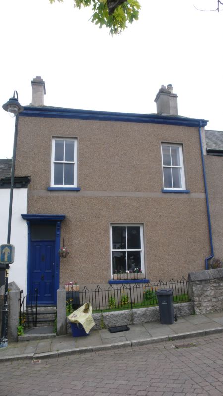
House. Mid-late C19th. Pebble-dashed, slate roof. 2 storeys and attic, 2 windows to 1st floor. Doorway to left with 4-panelled door and plain overlight beneath cornice on consoles. Large 4-pane sash to centre of ground floor has projecting stone sill. 1st floor: cemented band beneath sills of narrower 4-pane sashes. Moulded eaves; end stacks. INTERIOR not inspected. Formerly had blind window to 1st floor centre (Walton). (Walton J E: Dalton in Furness in Old Picture Postcards: Netherlands: 1983-: PL 20).
Listing NGR: SD2266273949
External links are from the relevant listing authority and, where applicable, Wikidata. Wikidata IDs may be related buildings as well as this specific building. If you want to add or update a link, you will need to do so by editing the Wikidata entry.


Other nearby listed buildings