Latitude: 50.7262 / 50°43'34"N
Longitude: -1.1631 / 1°9'47"W
OS Eastings: 459164
OS Northings: 92172
OS Grid: SZ591921
Mapcode National: GBR 9CN.DR1
Mapcode Global: FRA 87G5.6NV
Plus Code: 9C2WPRGP+FP
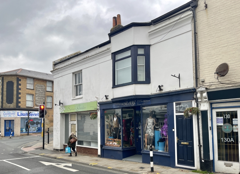
Entry Name: 128 and 129, High Street
Listing Date: 18 May 1972
Grade: II
Source: Historic England
Source ID: 1216916
English Heritage Legacy ID: 411631
ID on this website: 101216916
Location: Ryde, Isle of Wight, PO33
County: Isle of Wight
Civil Parish: Ryde
Built-Up Area: Ryde
Traditional County: Hampshire
Lieutenancy Area (Ceremonial County): Isle of Wight
Church of England Parish: Ryde
Church of England Diocese: Portsmouth
Tagged with: Building
HIGH STREET 1. 1577 (West Side) Nos 128 & 129 SZ 5992 3/224
II GV
2. Circa 1840 pair of small houses. Two storeys stucco faced. Concave cornice, frieze and parapet. One window each. Recessed, sash later glazing bars, block sill to No 128. Three light bay window, with high wood parapet plain apron, plain strips to No 129. Late Cl9 and modernised shop fronts.
Nos 128 to 131 (consec) form a group
Listing NGR: SZ5916492172
External links are from the relevant listing authority and, where applicable, Wikidata. Wikidata IDs may be related buildings as well as this specific building. If you want to add or update a link, you will need to do so by editing the Wikidata entry.


Other nearby listed buildings