Latitude: 54.0484 / 54°2'54"N
Longitude: -2.7978 / 2°47'51"W
OS Eastings: 347864
OS Northings: 461678
OS Grid: SD478616
Mapcode National: GBR 8PXM.2H
Mapcode Global: WH847.0H0R
Plus Code: 9C6V26X2+9V
Entry Name: 1, Dalton Square
Listing Date: 13 March 1995
Grade: II
Source: Historic England
Source ID: 1210398
English Heritage Legacy ID: 383128
ID on this website: 101210398
Location: Lancaster, Lancashire, LA1
County: Lancashire
District: Lancaster
Electoral Ward/Division: Castle
Parish: Non Civil Parish
Built-Up Area: Lancaster
Traditional County: Lancashire
Lieutenancy Area (Ceremonial County): Lancashire
Church of England Parish: Lancaster St Mary with St John and St Anne
Church of England Diocese: Blackburn
Tagged with: Building
LANCASTER
SD4761NE DALTON SQUARE 1685-1/7/97 (North side) No.1
GV II
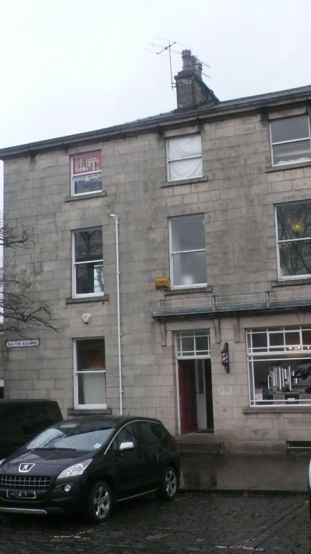
House, now a dental surgery. c1799, altered C19. Sandstone ashlar with ashlar dressings, and a slate roof with 2 chimney stacks. Narrow double-depth plan with the doorway on the left. 3 storeys above a cellar, and 2 bays with an eaves cornice. (The facade appears to have 3 bays, because the return wall of No.13 Great John Street (qv) to the left forms part of the total composition.) All the openings have plain reveals. The doorway and the ground-floor window (which has been widened to the left) are protected by a cornice carried on 4 consoles. The door is 8-panelled and has an overlight with margin panes, a motif copied in the steel-framed ground-floor window. All the other windows are sashed without glazing bars. HISTORY: Dalton Square was laid out as part of the development of the Friarage Estate from about 1784 onwards and Edward Batty is named on plans which accompany some of the leases.
Listing NGR: SD4786461678
External links are from the relevant listing authority and, where applicable, Wikidata. Wikidata IDs may be related buildings as well as this specific building. If you want to add or update a link, you will need to do so by editing the Wikidata entry.


Other nearby listed buildings