Latitude: 52.3378 / 52°20'16"N
Longitude: -2.2801 / 2°16'48"W
OS Eastings: 381013
OS Northings: 271118
OS Grid: SO810711
Mapcode National: GBR 0C0.DC2
Mapcode Global: VH920.FHGP
Plus Code: 9C4V8PQ9+4X
Entry Name: Stourport Yacht Club House
Listing Date: 5 July 1950
Last Amended: 11 October 1991
Grade: II
Source: Historic England
Source ID: 1209452
English Heritage Legacy ID: 393323
ID on this website: 101209452
Location: Stourport-on-Severn, Wyre Forest, Worcestershire, DY13
County: Worcestershire
District: Wyre Forest
Civil Parish: Stourport-on-Severn
Built-Up Area: Stourport-on-Severn
Traditional County: Worcestershire
Lieutenancy Area (Ceremonial County): Worcestershire
Church of England Parish: Stourport-on-Severn and Wilden
Church of England Diocese: Worcester
Tagged with: House
STOURPORT ON SEVERN
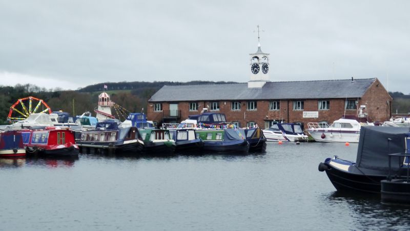
SO8171SW ENGINE LANE 589-1/9/16 (North side) 05/07/50 Stourport Yacht Club House (Formerly Listed as: ENGINE LANE Woodyard and Saw-mills (on basin side))
GV II
Club house, originally grain and general merchandise warehouse. Late C18, built for Staffordshire and Worcestershire Canal Company. Painted brick with slate roof. 2-storeyed, 10 bays. Some alterations to facade but original openings largely maintained, though one doorway apparently inserted in former window. External staircase to upper storey. Cambered brick heads to all windows. Roof is surmounted by wood clock tower with leaded cupola, added by public subscription in 1812. Original iron clock faces recently replaced. (The Canals of the British Isles: Hadfield Charles: The Canals of the West Midlands: Newton Abbot: 1966-; Porteous J D: Canal Ports: The Urban Achievement of the Canal Age: London: 1977-: 83-105).
Listing NGR: SO8101371118
External links are from the relevant listing authority and, where applicable, Wikidata. Wikidata IDs may be related buildings as well as this specific building. If you want to add or update a link, you will need to do so by editing the Wikidata entry.


Other nearby listed buildings