Latitude: 52.3389 / 52°20'19"N
Longitude: -2.2796 / 2°16'46"W
OS Eastings: 381047
OS Northings: 271235
OS Grid: SO810712
Mapcode National: GBR 0C0.6J6
Mapcode Global: VH920.FGQW
Plus Code: 9C4V8PQC+G5
Entry Name: York House
Listing Date: 5 May 1950
Grade: II
Source: Historic England
Source ID: 1292161
English Heritage Legacy ID: 393395
ID on this website: 101292161
Location: Stourport-on-Severn, Wyre Forest, Worcestershire, DY13
County: Worcestershire
District: Wyre Forest
Civil Parish: Stourport-on-Severn
Built-Up Area: Stourport-on-Severn
Traditional County: Worcestershire
Lieutenancy Area (Ceremonial County): Worcestershire
Church of England Parish: Stourport-on-Severn and Wilden
Church of England Diocese: Worcester
Tagged with: Building
This list entry was subject to a Minor Amendment on 21 January 2026 to amend the name and address and format the text to current standards
SO8171SW
589-1/9/77
STOURPORT ON SEVERN
YORK STREET (south side)
York House
(Formerly listed as York House, No 21, YORK STREET (south side))
05/05/50
GV
II
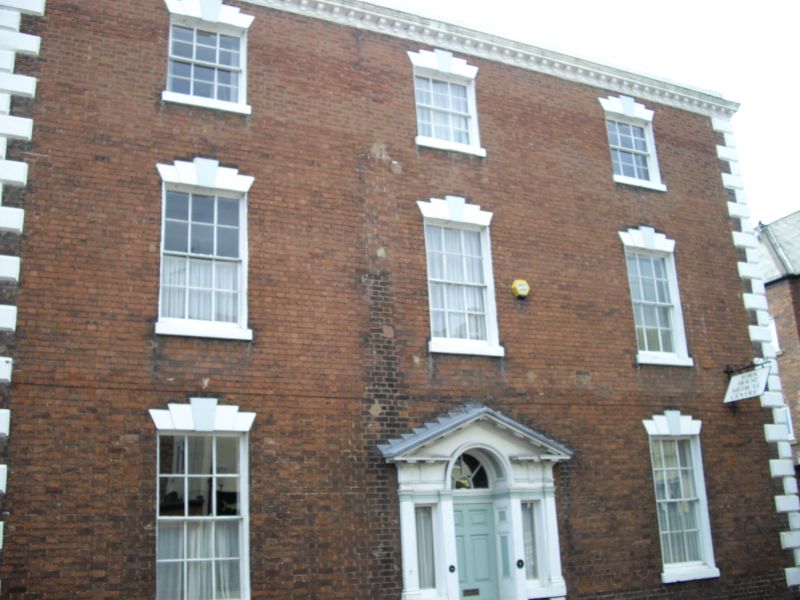
House. c1780. Brick with stone quoins and slate roof. Three-storeyed, three wide bays with central six-panelled door with round arched fan and side lights in pedimented case with triglyph capitals. Windows are twelve-pane sashes with flat-arched stuccoed heads with voussoirs and keystones. Stuccoed modillion eaves cornice, gable end stacks. Lower bay to left a slightly later addition, rebuilt to ground floor, and with one blind window above. Rear elevation of principal range has two Palladian windows to first floor, canted bays to ground floor, and parapet eaves cornice.
Listing NGR: SO8107071221
External links are from the relevant listing authority and, where applicable, Wikidata. Wikidata IDs may be related buildings as well as this specific building. If you want to add or update a link, you will need to do so by editing the Wikidata entry.


Other nearby listed buildings