Latitude: 53.2657 / 53°15'56"N
Longitude: -2.1154 / 2°6'55"W
OS Eastings: 392397
OS Northings: 374309
OS Grid: SJ923743
Mapcode National: GBR FZNP.T1
Mapcode Global: WHBBP.G5WR
Plus Code: 9C5V7V8M+7R
Entry Name: Hurdsfield House
Listing Date: 17 March 1977
Grade: II
Source: Historic England
Source ID: 1206883
English Heritage Legacy ID: 390908
ID on this website: 101206883
Location: Hurdsfield, Cheshire East, Cheshire, SK10
County: Cheshire East
Civil Parish: Macclesfield
Built-Up Area: Macclesfield
Traditional County: Cheshire
Lieutenancy Area (Ceremonial County): Cheshire
Church of England Parish: Hurdsfield Holy Trinity
Church of England Diocese: Chester
Tagged with: English country house
MACCLESFIELD
SJ97SW BROCKLEHURST AVENUE 886-1/4/8 (North side) 17/03/77 Hurdsfield House
II
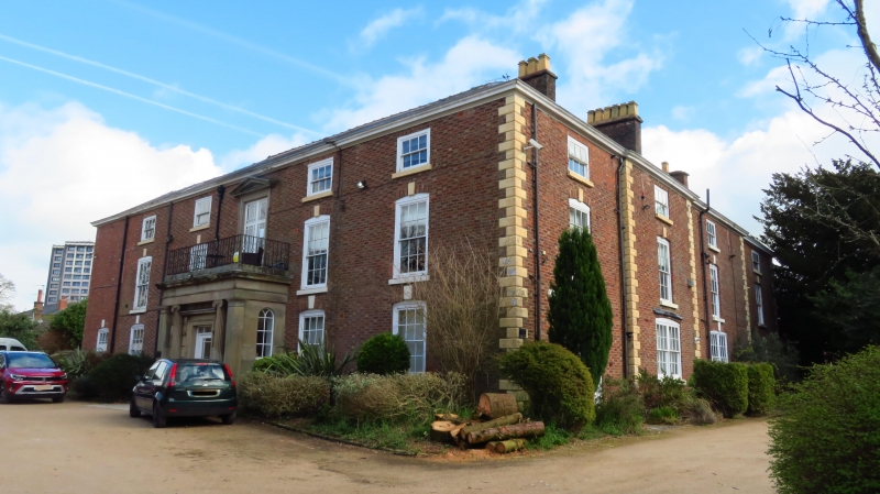
House, formerly used as welfare centre, disused at time of survey. c1800 with later alterations. Brick with stone dressings and Welsh slate roof. 3-storeyed. Entrance front faces west: 5-window range with central doorway in stone porch with Doric architrave, and wrought-iron railings to balcony above tall window with entablature above, probably lighting entrance and stair hall. Flanking windows are sashes (mainly boarded over at time of inspection) in moulded architraves. Angle quoins. South front originally a 3-window range with slightly advanced central bay, extended by 1 bay to the right. Windows mostly renewed in original openings with flat-arched gauged brick heads with keystones. To the rear, in the angle of the 2 main ranges, a hipped roofed mid C19 service extension. Said to have been built by the Brocklehurst family, a noted local silk manufacturing family.
Listing NGR: SJ9239774309
External links are from the relevant listing authority and, where applicable, Wikidata. Wikidata IDs may be related buildings as well as this specific building. If you want to add or update a link, you will need to do so by editing the Wikidata entry.


Other nearby listed buildings