Latitude: 52.6309 / 52°37'51"N
Longitude: 1.3012 / 1°18'4"E
OS Eastings: 623502
OS Northings: 308795
OS Grid: TG235087
Mapcode National: GBR WB6.CN
Mapcode Global: WHMTM.Y4TG
Plus Code: 9F43J8J2+8F
Entry Name: 64, the Close
Listing Date: 5 June 1972
Last Amended: 8 April 1986
Grade: II
Source: Historic England
Source ID: 1206428
English Heritage Legacy ID: 228972
ID on this website: 101206428
Location: The Close, Norwich, Norfolk, NR1
County: Norfolk
District: Norwich
Electoral Ward/Division: Thorpe Hamlet
Parish: Non Civil Parish
Built-Up Area: Norwich
Traditional County: Norfolk
Lieutenancy Area (Ceremonial County): Norfolk
Tagged with: Building
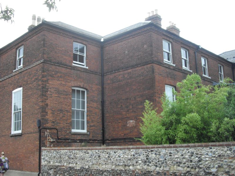
TG 2308 NWTG 2308 NE, TG 2308 NW THE CLOSE 16/223, 17/223 5.6.72 No. 64 (formerly listed as Nos.63,64,64A and 64B GV II Former house, now offices and flats. C19 with mediaeval remains. Flint north wall. Red brick and slate roof. T-shape plan with double-pile range of unequal length. 2 blocked stone arches in the north wall. East facade:- 3 storeys. One bay set back. 4 bays plus 2 bays to right projecting. Sash windows throughout with rubbed brick segmental arches. 2 storey canted bay to right. Stringcourse between floors. Sawtooth cornice. Hipped roof. 2 bowtell moulded shafts embedded in internal ground floor wall.
Listing NGR: TG2350208794
External links are from the relevant listing authority and, where applicable, Wikidata. Wikidata IDs may be related buildings as well as this specific building. If you want to add or update a link, you will need to do so by editing the Wikidata entry.


Other nearby listed buildings