Latitude: 51.4568 / 51°27'24"N
Longitude: -2.5982 / 2°35'53"W
OS Eastings: 358534
OS Northings: 173266
OS Grid: ST585732
Mapcode National: GBR C7J.CL
Mapcode Global: VH88M.XN91
Plus Code: 9C3VFC42+PP
Entry Name: The Old Rectory and Attached Rear Wall
Listing Date: 8 January 1959
Last Amended: 30 December 1994
Grade: II
Source: Historic England
Source ID: 1206378
English Heritage Legacy ID: 379956
ID on this website: 101206378
Location: Tyndall's Park, Bristol, BS2
County: City of Bristol
Electoral Ward/Division: Central
Parish: Non Civil Parish
Built-Up Area: Bristol
Traditional County: Gloucestershire
Lieutenancy Area (Ceremonial County): Bristol
Church of England Parish: Bristol St Stephen with St James and St John the Baptist with St Michael and St George
Church of England Diocese: Bristol
Tagged with: Clergy house
BRISTOL
ST5873SE LOWER CHURCH LANE 901-1/11/134 (North West side) 08/01/59 The Old Rectory and attached rear wall (Formerly Listed as: LOWER CHURCH LANE The Old Rectory)
II
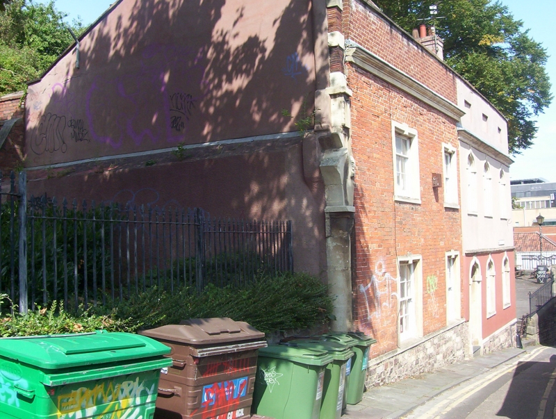
House. c1470, partially refronted c1770; contained late C16 panelling. Render and brick with limestone dressings, rubble plinth, brick gable stacks and pantile hipped roof. Double-depth plan including right-hand rear wings. 2 storeys and attic; 5-window range. In 2 sections, 2:3 windows stepped up to the left-hand brickwork, render to the right, with a band above the plinth, a ground-floor drip to the right, differently moulded cornices, stepped up, and a continuous coped parapet. c1770 right-hand section has raised, coved surrounds and ogee heads, a left-hand doorway with interlacing overlight and 6-panel door with the upper 4 raised, and 6/6-pane sashes, with interlacing heads, and 3 sunken panels to the parapet. C19 left-hand section has keyed architraves to horned 6/6-pane ground-floor sashes, and 4/8-pane first-floor sashes. The drip and cornice extend into the right-hand return as far as the external gable stack, windows as the front to each side, no right-hand ground-floor window, with a rear single-storey block. A continuous roof with 2 hipped dormers to the rear and 3 hips to the front. INTERIOR not accessible, but reported as having a left-hand lateral stair flight with uncut string, column-on-vase balusters and a ramped rail. SUBSIDIARY FEATURES: attached wall to NE corner. HISTORICAL NOTE: formerly the rectory to St Michael's Church (qv), c1470, which was largely rebuilt 1775 by Thomas Paty, who may have introduced the ogee fenestration to the rectory. Fine late C16 panelling was removed to the Red Lodge (qv), and is now in the ground floor Oak Room there. A house on the site is marked on Millerd's Map of Bristol, 1673. (Gomme A, Jenner M and Little B: Bristol, An Architectural History: Bristol: 1979-: 78; Millerd's Map of Bristol: 1673-).
Listing NGR: ST5853473266
External links are from the relevant listing authority and, where applicable, Wikidata. Wikidata IDs may be related buildings as well as this specific building. If you want to add or update a link, you will need to do so by editing the Wikidata entry.


Other nearby listed buildings