Latitude: 51.3317 / 51°19'54"N
Longitude: 1.4135 / 1°24'48"E
OS Eastings: 637884
OS Northings: 164714
OS Grid: TR378647
Mapcode National: GBR X0L.J5T
Mapcode Global: VHMCW.GS3G
Plus Code: 9F338CJ7+MC
Entry Name: Vale House
Listing Date: 4 February 1988
Grade: II
Source: Historic England
Source ID: 1203863
English Heritage Legacy ID: 172075
ID on this website: 101203863
Location: Ramsgate, Thanet, Kent, CT11
County: Kent
District: Thanet
Civil Parish: Ramsgate
Built-Up Area: Ramsgate
Traditional County: Kent
Lieutenancy Area (Ceremonial County): Kent
Tagged with: House
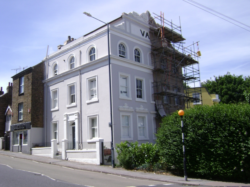
RAMSGATE WEST CLIFF ROAD TR 3764 NE (north side) 12/439 Vale House GV II House, now school. 1840's. Rendered with slate roof. Three storeys and attic storey, the second floor set back behind a moulded cornice, with parapet to attic block, with 2 casement windows. Stacks to left and to right. Three round-headed sashes with Y-tracery on 2nd floor, 3 wooden casements with half-mullion and transom in moulded surrounds on first floor, and 2 sashes on ground floor in moulded surrounds with central half-glazed door with elliptical fanlight in pilaster surround at head of 3 steps. Right return: 5 bay front, with 4 sash on ground and first floors with scrolled shell pediment and 4 round headed sash on second floors, all floors with central blank panel. The attic storey moulded into a vast scrolled pediment with the word "Vale" raised on a central panel. The reference is to the Vale, for the history of which refer to item 12/389 . Vale House was probably built by the builder William Saxby as part of James Creed Eddell's development of The Vale, 1840-1850. (See Busson, Book of Ramsgate, 127-8).
Listing NGR: TR3788464714
External links are from the relevant listing authority and, where applicable, Wikidata. Wikidata IDs may be related buildings as well as this specific building. If you want to add or update a link, you will need to do so by editing the Wikidata entry.


Other nearby listed buildings