Latitude: 51.3321 / 51°19'55"N
Longitude: 1.4138 / 1°24'49"E
OS Eastings: 637900
OS Northings: 164754
OS Grid: TR379647
Mapcode National: GBR X0L.J7W
Mapcode Global: VHMCW.GS86
Plus Code: 9F338CJ7+RG
Entry Name: Nos 1-9 Inclusive, with Railed Areas and Gardens
Listing Date: 21 September 1984
Grade: II
Source: Historic England
Source ID: 1203491
English Heritage Legacy ID: 172023
ID on this website: 101203491
Location: Ramsgate, Thanet, Kent, CT11
County: Kent
District: Thanet
Civil Parish: Ramsgate
Built-Up Area: Ramsgate
Traditional County: Kent
Lieutenancy Area (Ceremonial County): Kent
Tagged with: Building
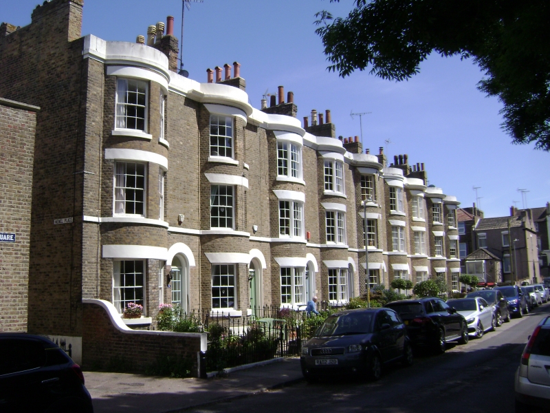
RAMSGATE VALE SQUARE TR 3764 NE (east side) 12/387 Nos. 1 - 9 inclusive, with 21.9.84 railed Areas and gardens GV II Terrace row. Circa 1822-36. Stock brick and slate roof. Three storeys and basement, with continuous sill band to first floor, and cornice and parapet, in part damaged. Stacks ranged left to right. Each house has a full height bow, numbers 1,2,5,8 and 9 with two glazing bar sashes each floor, numbers 3,4,6, and 7 with three, all with rendered heads. Variety of panelled and half-glazed doors to right of bows with semi- circular double rebated surrounds with rendered heads. Low, spear headed rails to basement Areas and a garden dividing fences. Although the composition of the whole is united by the fenestration variation (4 windows, 6,2,6,4), the terrace was built over a decade or more in 4 blocks. At some time known as Victoria Place, J. C. Eddels lived at No. 5 whilst developing the rest of Vale Square. (See item 12/389).
Listing NGR: TR3790064754
External links are from the relevant listing authority and, where applicable, Wikidata. Wikidata IDs may be related buildings as well as this specific building. If you want to add or update a link, you will need to do so by editing the Wikidata entry.


Other nearby listed buildings