Latitude: 51.0905 / 51°5'25"N
Longitude: -2.271 / 2°16'15"W
OS Eastings: 381115
OS Northings: 132388
OS Grid: ST811323
Mapcode National: GBR 0V3.GNQ
Mapcode Global: FRA 6647.M2B
Plus Code: 9C3V3PRH+5H
Entry Name: Manderley
Listing Date: 7 July 1989
Grade: II
Source: Historic England
Source ID: 1199898
English Heritage Legacy ID: 320147
ID on this website: 101199898
Location: Mere, Wiltshire, BA12
County: Wiltshire
Civil Parish: Mere
Built-Up Area: Mere
Traditional County: Wiltshire
Lieutenancy Area (Ceremonial County): Wiltshire
Church of England Parish: Mere St Michael the Archangel
Church of England Diocese: Salisbury
Tagged with: Building
ST 8032-8132 MERE CASTLE STREET (north side)
6/18 Manderley
GV II
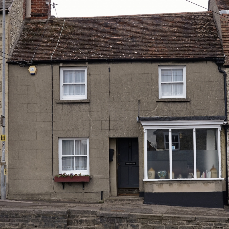
House in street row. C18 but later fenestration. Rendered and scribed, plain tile roof. Two storeys, 2 windows, 4-paned horned sashes, but ground floor right is former display window as square flat-roofed bay in 1:3:1 lights to stall riser; deep-set 4-panel door, centre. Large brick stack to left. Included for group value.
Listing NGR: ST8111532388
External links are from the relevant listing authority and, where applicable, Wikidata. Wikidata IDs may be related buildings as well as this specific building. If you want to add or update a link, you will need to do so by editing the Wikidata entry.


Other nearby listed buildings