Latitude: 50.4712 / 50°28'16"N
Longitude: -4.7183 / 4°43'5"W
OS Eastings: 207202
OS Northings: 67019
OS Grid: SX072670
Mapcode National: GBR N2.MRTS
Mapcode Global: FRA 170T.7MR
Plus Code: 9C2QF7CJ+FM
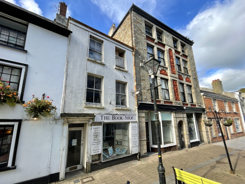
Entry Name: 13, Honey Street
Listing Date: 8 June 1972
Grade: II
Source: Historic England
Source ID: 1195271
English Heritage Legacy ID: 368014
ID on this website: 101195271
Location: Bodmin, Cornwall, PL31
County: Cornwall
Civil Parish: Bodmin
Built-Up Area: Bodmin
Traditional County: Cornwall
Lieutenancy Area (Ceremonial County): Cornwall
Church of England Parish: Bodmin
Church of England Diocese: Truro
Tagged with: Building
BODMIN
SX0767 HONEY STREET 629-1/2/72 (North West side) 08/06/72 No.13
GV II
Town house with later shop. Probably mid C19. Incised stucco to front; rag slate roof with slate verge on the left. Double-depth plan. 3 storeys; 2-window range. Late C19 four-pane horned sashes. Ground floor has original pilastered doorway with moulded entablature; C20 door and shop window on the right. INTERIOR: not inspected.
Listing NGR: SX0720267019
External links are from the relevant listing authority and, where applicable, Wikidata. Wikidata IDs may be related buildings as well as this specific building. If you want to add or update a link, you will need to do so by editing the Wikidata entry.


Other nearby listed buildings