Latitude: 52.6763 / 52°40'34"N
Longitude: -2.174 / 2°10'26"W
OS Eastings: 388329
OS Northings: 308747
OS Grid: SJ883087
Mapcode National: GBR 18D.95J
Mapcode Global: WHBFC.KZYN
Plus Code: 9C4VMRGG+G9
Entry Name: Glenhouse
Listing Date: 19 March 1962
Grade: II
Source: Historic England
Source ID: 1178353
English Heritage Legacy ID: 271381
ID on this website: 101178353
Location: Brewood, South Staffordshire, ST19
County: Staffordshire
District: South Staffordshire
Civil Parish: Brewood and Coven
Built-Up Area: Brewood
Traditional County: Staffordshire
Lieutenancy Area (Ceremonial County): Staffordshire
Church of England Parish: Brewood St Mary and St Chad
Church of England Diocese: Lichfield
Tagged with: Building
BREWOOD C.P. MARKET PLACE SJ 8808-8908 (East side)
13/72 No. 8 (Glenhouse) 19.3.62
G.V. II
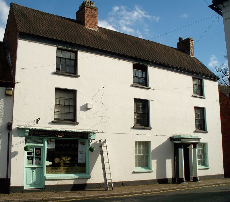
House incorporating shop. Mid to late C18. Red brick, front plastered and lined as ashlar; clay tile roof; brick stacks. 3 storeys; 3 window front; glazing bar sashes; 6 panelled door in Tuscan portico with fluted necking to columns; C20 shop front to left hand of ground floor.
Listing NGR: SJ8832908747
External links are from the relevant listing authority and, where applicable, Wikidata. Wikidata IDs may be related buildings as well as this specific building. If you want to add or update a link, you will need to do so by editing the Wikidata entry.


Other nearby listed buildings