Latitude: 54.488 / 54°29'16"N
Longitude: -1.8736 / 1°52'24"W
OS Eastings: 408287
OS Northings: 510298
OS Grid: NZ082102
Mapcode National: GBR HJCJ.5Z
Mapcode Global: WHC5Y.6G29
Plus Code: 9C6WF4QG+5H
Entry Name: The Laurels
Listing Date: 28 October 1987
Grade: II
Source: Historic England
Source ID: 1160039
English Heritage Legacy ID: 111612
ID on this website: 101160039
Location: Barningham, County Durham, DL11
County: County Durham
Civil Parish: Barningham
Traditional County: Yorkshire
Lieutenancy Area (Ceremonial County): County Durham
Church of England Parish: Barningham St Michael and All Angels
Church of England Diocese: Leeds
Tagged with: Architectural structure
NZ 0810 BARNINGHAM BARNINGHAM VILLAGE (North side)
15/23 The Laurels
GV II
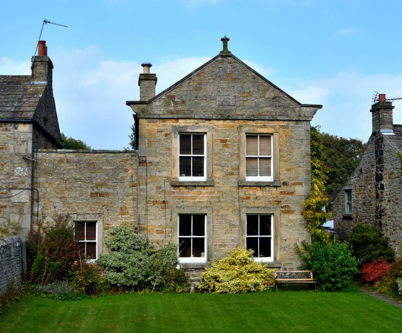
House, dated 1818 with initials W.T. (William Todd). South front squared stone, returns rubble, part pebbledashed; tooled-and-margined quoins and tooled dressings. Graduated Lakeland slate roof except for C20 metal sheets on single-storey part.
2-storey, 2-bay gable end to road. 4-pane sash windows in stone surrounds with projecting sills. Band below coped gable on moulded kneelers; datestone in gable and moulded finial at apex. On left a single-storey bay with similar window, and parapet front with flat coping.
Right return has left-of-centre 6-panel door in stone surround under hood on moulded brackets incorporated in later Cl9 castellated porch. 4-pane sash in raised stone surround above; to right a second stone-surround doorway, now blocked. Left return shows 12-pane sash stair window in raised stone surround and 2 banded lateral stacks. Gabled rear elevation.
Listing NGR: NZ0828710298
External links are from the relevant listing authority and, where applicable, Wikidata. Wikidata IDs may be related buildings as well as this specific building. If you want to add or update a link, you will need to do so by editing the Wikidata entry.


Other nearby listed buildings