Latitude: 54.4876 / 54°29'15"N
Longitude: -1.8733 / 1°52'24"W
OS Eastings: 408302
OS Northings: 510254
OS Grid: NZ083102
Mapcode National: GBR HJCK.73
Mapcode Global: WHC5Y.6G5M
Plus Code: 9C6WF4QG+2M
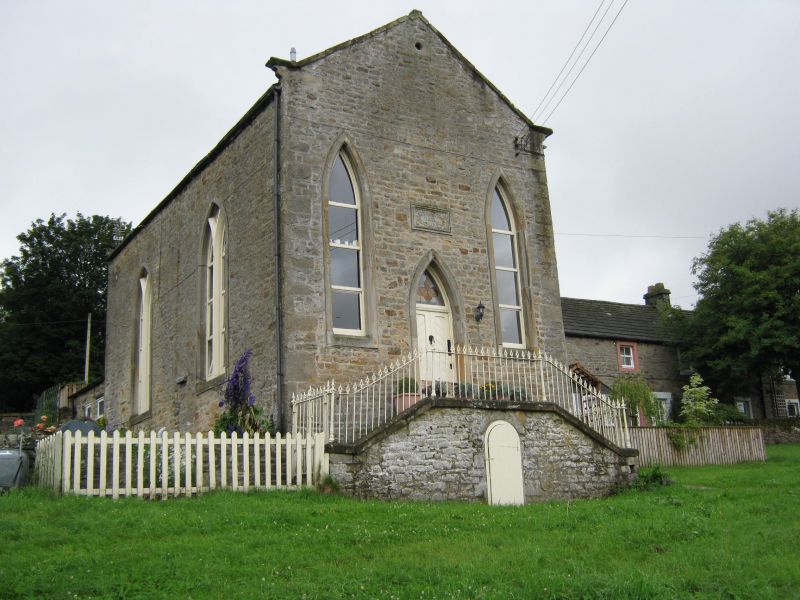
Entry Name: Former Methodist Chapel
Listing Date: 28 October 1987
Grade: II
Source: Historic England
Source ID: 1121727
English Heritage Legacy ID: 111643
ID on this website: 101121727
Location: Barningham, County Durham, DL11
County: County Durham
Civil Parish: Barningham
Traditional County: Yorkshire
Lieutenancy Area (Ceremonial County): County Durham
Church of England Parish: Barningham St Michael and All Angels
Church of England Diocese: Leeds
Tagged with: Chapel
NZ 0810 BARNINGHAM BARNINGHAM VILLAGE (South side)
15/54 Former Methodist Chapel
GV II
Methodist Chapel dated 1815, converted to house c.1980. Coursed rubble with roughly-shaped quoins and tooled ashlar dressings; stone slate roof. Gabled front to street. Railings with foliate heads and moulded standards, and similar double gates, enclose double flight of steps up to central panelled double doors under pointed arch. Moulded tablet above with 'WESLEYAN METHODIST CHAPEL' and date, between tall lancet windows with renewed glazing. All openings in raised chamfered surrounds. Coped gable on moulded kneelers; small round opening in apex. Each return shows two 2-light windows with wooden Y-tracery; in addition there are several blocked openings on the right return. Small stack at apex of rear gable.
Interior altered.
The building is said to have been a barn prior to its conversion to a chapel; however the architectural features could be explained by mid-C19 remodelling of the 1815 chapel commemorated by datestone.
Listing NGR: NZ0830210254
External links are from the relevant listing authority and, where applicable, Wikidata. Wikidata IDs may be related buildings as well as this specific building. If you want to add or update a link, you will need to do so by editing the Wikidata entry.


Other nearby listed buildings