Latitude: 51.5514 / 51°33'5"N
Longitude: -0.8182 / 0°49'5"W
OS Eastings: 482035
OS Northings: 184275
OS Grid: SU820842
Mapcode National: GBR D60.PY2
Mapcode Global: VHDWH.R8SJ
Plus Code: 9C3XH52J+HP
Entry Name: Wittington Winch
Listing Date: 20 August 1974
Grade: II
Source: Historic England
Source ID: 1159994
English Heritage Legacy ID: 47041
ID on this website: 101159994
Location: Hurley, Buckinghamshire, SL7
County: Buckinghamshire
Civil Parish: Medmenham
Built-Up Area: Hurley
Traditional County: Buckinghamshire
Lieutenancy Area (Ceremonial County): Berkshire
Church of England Parish: Medmenham
Church of England Diocese: Oxford
Tagged with: Architectural structure
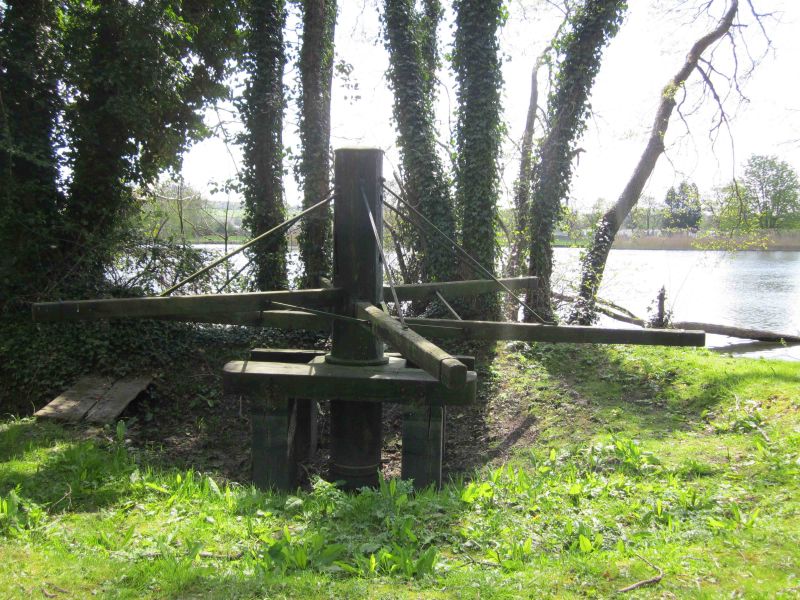
MEDMENHAM THAMES TOWPATH SU 88 SW (HURLEY WEIR) 8/158 Wittington Winch 20.8.74 - II Winch. C18, last used in 1774 when Hurley Lock was opened. Wooden capstan with metal cap and metal tie bars to 5 wooden arms. Part sunk into pit with 2 retaining beams. Used to haul barges up flash lock at Hurley Weir. (Country Life July 5th 1984 p. 32. A.H. Plaisted, The Manor and Parish Records of Medmenham, 1925).
Listing NGR: SU8203584275
External links are from the relevant listing authority and, where applicable, Wikidata. Wikidata IDs may be related buildings as well as this specific building. If you want to add or update a link, you will need to do so by editing the Wikidata entry.


Other nearby listed buildings