Latitude: 51.8302 / 51°49'48"N
Longitude: -1.837 / 1°50'13"W
OS Eastings: 411331
OS Northings: 214636
OS Grid: SP113146
Mapcode National: GBR 3PR.BD5
Mapcode Global: VHB27.38Q9
Plus Code: 9C3WR5J7+36
Entry Name: Farrier's
Listing Date: 23 January 1952
Last Amended: 25 March 1987
Grade: II
Source: Historic England
Source ID: 1155146
English Heritage Legacy ID: 130529
ID on this website: 101155146
Location: Northleach, Cotswold, Gloucestershire, GL54
County: Gloucestershire
District: Cotswold
Civil Parish: Northleach with Eastington
Built-Up Area: Northleach
Traditional County: Gloucestershire
Lieutenancy Area (Ceremonial County): Gloucestershire
Church of England Parish: Northleach St Peter and St Paul
Church of England Diocese: Gloucester
Tagged with: Building
NORTHLEACH WITH HIGH STREET SP 1114 EASTINGTON (north side), Northleach 8/92 Farriers (formerly listed as Failthe) 23.1.52 GV II
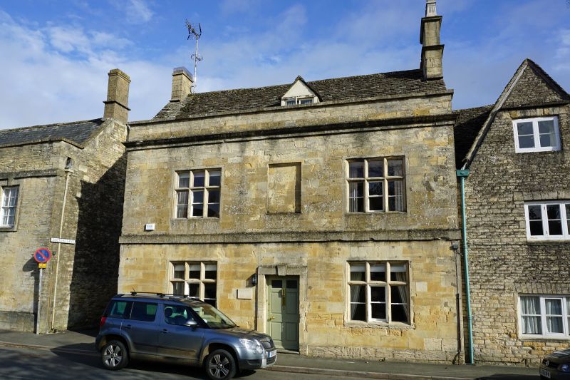
House at end of row. Early-mid C18 with later extensions. Coursed squared and dressed limestone, ashlar facade, stone slate roof, one ashlar and one C20 artificial stone stack. Rectangular main body with two later extensions at right angles at rear. Symmetrical, 3- bay facade. Two storeys and attic lit by gabled roof dormer. Three-light stone-mullioned casements wth transoms to ground and first floors. Blind window between upper floor casements. Central fielded 6-panel door (upper 2 panels glazed) within plain stone surround with keystone. Band between ground and first floors. Blocked cellar access at left gable end. Parapet with moulded cornice. Stacks at gable ends. Interior not inspected.
Listing NGR: SP1133114636
External links are from the relevant listing authority and, where applicable, Wikidata. Wikidata IDs may be related buildings as well as this specific building. If you want to add or update a link, you will need to do so by editing the Wikidata entry.


Other nearby listed buildings