Latitude: 51.4435 / 51°26'36"N
Longitude: -0.9576 / 0°57'27"W
OS Eastings: 472540
OS Northings: 172122
OS Grid: SU725721
Mapcode National: GBR QPL.Z0
Mapcode Global: VHDWT.CZ3B
Plus Code: 9C3XC2VR+9W
Entry Name: Wall between 57 and 59 Christchurch Road
Listing Date: 14 December 1978
Last Amended: 16 May 1979
Grade: II
Source: Historic England
Source ID: 1154887
English Heritage Legacy ID: 38849
ID on this website: 101154887
Location: The Mount, Reading, Berkshire, RG2
County: Reading
Electoral Ward/Division: Redlands
Parish: Non Civil Parish
Built-Up Area: Reading
Traditional County: Berkshire
Lieutenancy Area (Ceremonial County): Berkshire
Church of England Parish: Reading Christ Church
Church of England Diocese: Oxford
Tagged with: Wall
This list entry was subject to a Minor Amendment on 21 January 2026 to amend the name and address, and reformat the text to current standards.
CHRISTCHURCH ROAD (north side)
Wall between Nos 57 and 59
(Formerly listed as Wall between Nos 57 and 59, THE MOUNT, previously listed as Wall between Nos 57 and 59 The Mount, CHRISTCHURCH ROAD)
GV
II
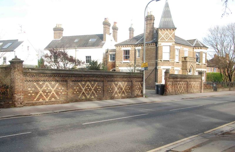
Circa 1876. In two sections. Gates missing and opening widened. About 6 foot 6 inches high. Brick with 3½ and 2½ paler yellow diaper patterns and cogged courses below moulded capping. End piers with moulded capping.
Listing NGR: SU7253972122
External links are from the relevant listing authority and, where applicable, Wikidata. Wikidata IDs may be related buildings as well as this specific building. If you want to add or update a link, you will need to do so by editing the Wikidata entry.


Other nearby listed buildings