Latitude: 51.6751 / 51°40'30"N
Longitude: -2.0024 / 2°0'8"W
OS Eastings: 399928
OS Northings: 197374
OS Grid: ST999973
Mapcode National: GBR 2PY.Y9X
Mapcode Global: VHB2X.75R5
Plus Code: 9C3VMXGX+32
Entry Name: Mill Farmhouse
Listing Date: 27 February 1986
Grade: II
Source: Historic England
Source ID: 1153318
English Heritage Legacy ID: 129343
ID on this website: 101153318
Location: Ewen, Cotswold, Gloucestershire, GL7
County: Gloucestershire
District: Cotswold
Civil Parish: Kemble
Built-Up Area: Ewen
Traditional County: Wiltshire
Lieutenancy Area (Ceremonial County): Gloucestershire
Church of England Parish: Kemble All Saints
Church of England Diocese: Gloucester
Tagged with: Farmhouse
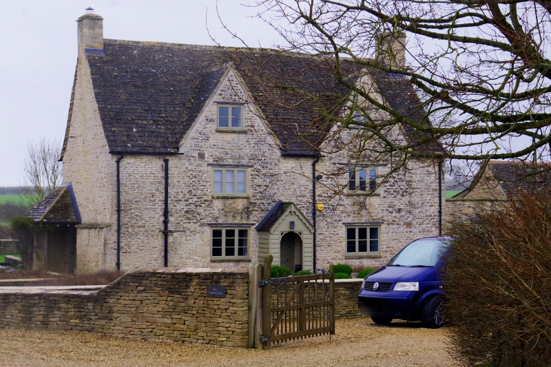
KEMBLE EWEN ST 99 NE 7/46 Mill Farmhouse II Farmhouse. Late C17. Random coursed rubble stone, stone slate roof, stone end stacks. Probably through passage, single main range with small rear extension, 2 storeys and attic. Two gables to front, each with 2-light wood casement at top, 3-light on first floor and ground floor, all with timber lintels. Central moulded wood doorcase with arched door of 6 fielded panels, top 2 following arch and forming decorative shape. Projecting C19 boarded gabled porch.
Listing NGR: ST9992897374
External links are from the relevant listing authority and, where applicable, Wikidata. Wikidata IDs may be related buildings as well as this specific building. If you want to add or update a link, you will need to do so by editing the Wikidata entry.


Other nearby listed buildings