Latitude: 54.1196 / 54°7'10"N
Longitude: -0.8987 / 0°53'55"W
OS Eastings: 472080
OS Northings: 469863
OS Grid: SE720698
Mapcode National: GBR QN5T.70
Mapcode Global: WHFBF.5Q96
Plus Code: 9C6X4492+RG
Entry Name: Cascade
Listing Date: 22 June 1987
Grade: II
Source: Historic England
Source ID: 1148972
English Heritage Legacy ID: 329011
ID on this website: 101148972
Location: North Yorkshire, YO60
County: North Yorkshire
District: Ryedale
Civil Parish: Henderskelfe
Traditional County: Yorkshire
Lieutenancy Area (Ceremonial County): North Yorkshire
Church of England Parish: Bulmer St Martin
Church of England Diocese: York
Tagged with: Building
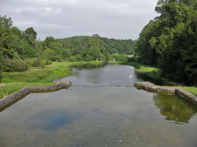
HENDERSKELFE SOUTH LAKE SE 76 NW (west end) Castle Howard 7/55 Cascade GV II Cascade. c1850. By W A Nesfield. Millstone grit. Upper pool square on plan with rounded corners leading to cascade with square lower pool. Cascade has rusticated bands. Low chamfered walls to sides terminating in square piers with stepped cornices. HBMC, Register of Parks and Gardens of special historic interest in England, Part 32, North Yorkshire: Castle Howard, Grade I.
Listing NGR: SE7208069863
External links are from the relevant listing authority and, where applicable, Wikidata. Wikidata IDs may be related buildings as well as this specific building. If you want to add or update a link, you will need to do so by editing the Wikidata entry.


Other nearby listed buildings