Latitude: 51.1316 / 51°7'53"N
Longitude: 1.3036 / 1°18'12"E
OS Eastings: 631230
OS Northings: 142116
OS Grid: TR312421
Mapcode National: GBR X2S.SHC
Mapcode Global: VHLHB.KT0C
Plus Code: 9F3348J3+JC
Entry Name: 305, 306 and 307, London Road
Listing Date: 17 December 1973
Grade: II
Source: Historic England
Source ID: 1145864
English Heritage Legacy ID: 177800
ID on this website: 101145864
Location: Dover, Kent, CT17
County: Kent
District: Dover
Civil Parish: Dover
Built-Up Area: Dover
Traditional County: Kent
Lieutenancy Area (Ceremonial County): Kent
Tagged with: Building
LONDON ROAD 1. (South West Side) 1050 Nos 305, 306 and 307 TR 3142 3/45
II GV
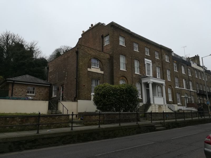
2. Circa 1840. 3 storeys and basement. Brown brick on stuccoed base, End window bays project slightly. Cornice and parapet. 5 windows. Centre lst floor window set in stuccoed reveal with architrave over. Round-headed windows on ground floor with glazing bars intact. Porch with fluted Ionic columns up a double flight of 8 steps the shape of a mounting block with an iron handrail and solid stuccoed parapet between the columns. 6 panel moulded doors with semi-circular fanlight. Extension of 2 storeys and 1 window to the south.
Nos 279 to 319 (consec) form a group.
Listing NGR: TR3123042116
External links are from the relevant listing authority and, where applicable, Wikidata. Wikidata IDs may be related buildings as well as this specific building. If you want to add or update a link, you will need to do so by editing the Wikidata entry.


Other nearby listed buildings