Latitude: 51.371 / 51°22'15"N
Longitude: -2.5498 / 2°32'59"W
OS Eastings: 361825
OS Northings: 163694
OS Grid: ST618636
Mapcode National: GBR JS.SWWN
Mapcode Global: VH891.RSDV
Plus Code: 9C3V9FC2+C3
Entry Name: Church of St Thomas a Becket
Listing Date: 24 September 1984
Grade: II*
Source: Historic England
Source ID: 1136393
English Heritage Legacy ID: 32618
Also known as: St Thomas a Becket Church, Pensford
ID on this website: 101136393
Location: Pensford, Bath and North East Somerset, Somerset, BS39
County: Bath and North East Somerset
Civil Parish: Publow
Built-Up Area: Pensford
Traditional County: Somerset
Lieutenancy Area (Ceremonial County): Somerset
Tagged with: Church building
ST 66 SW PUBLOW CHURCH STREET, Pensford (south side) 6/189 Church of St. Thomas a Becket G.V. II*
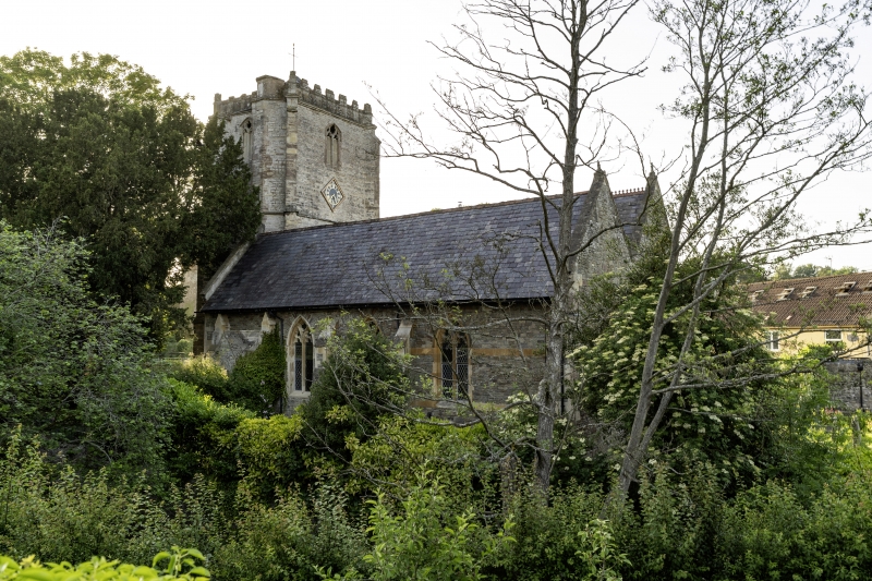
Parish church. Late C14 tower, the rest of the church rebuilt in 1869 by C.E. Giles of Taunton. Consists of west tower, nave and north porch, south aisle and south porch, and chancel. Coursed limestone rubble with ashlar dressings to the tower; coursed sandstone rubble to the remainder with ashlar bands and dressings, slate roofs. West tower of 3 stages with angle buttresses, pyramidal slate roof set back behind embattled parapet, the merlons of which are pierced with cross-loops; projecting polygonal stair tower at south-east; 2-light bell chamber windows with cusped heads and pierced stone grille; blocked west door in moulded and pointed surround and restored 3-light west window. The body of the church has a mixture of Decorated style windows with buttresses between the bays. North and south gabled projecting porches and short east end. Interior. Tierceron vault to tower with central open roundel for bell ropes. Scissor braced rafters with crown post on tie beam between nave and chancel. (N. Pevsner, The Buildings of England : North Somerset and Bristol, 1958).
Listing NGR: ST6182563694
External links are from the relevant listing authority and, where applicable, Wikidata. Wikidata IDs may be related buildings as well as this specific building. If you want to add or update a link, you will need to do so by editing the Wikidata entry.


Other nearby listed buildings