Latitude: 51.3713 / 51°22'16"N
Longitude: -2.5492 / 2°32'57"W
OS Eastings: 361868
OS Northings: 163720
OS Grid: ST618637
Mapcode National: GBR JS.SX1R
Mapcode Global: VH891.RSQN
Plus Code: 9C3V9FC2+G8
Entry Name: Bridge over the River Chew
Listing Date: 21 September 1960
Grade: II
Source: Historic England
Source ID: 1129492
English Heritage Legacy ID: 32619
ID on this website: 101129492
Location: Pensford, Bath and North East Somerset, Somerset, BS39
County: Bath and North East Somerset
Civil Parish: Publow
Built-Up Area: Pensford
Traditional County: Somerset
Lieutenancy Area (Ceremonial County): Somerset
Tagged with: Bridge
ST 66 SW PUBLOW CHURCH STREET, Pensford
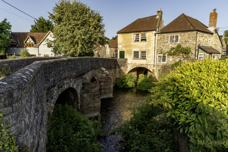
6/190 Bridge over the River Chew 21.9.60 II G.V. Bridge. Late mediaeval. Rubble. 3 arches, the central one is slightly pointed and the west one is pointed with freestone buttresses. Cutwaters between and restored parapet.
Listing NGR: ST6186863719
External links are from the relevant listing authority and, where applicable, Wikidata. Wikidata IDs may be related buildings as well as this specific building. If you want to add or update a link, you will need to do so by editing the Wikidata entry.


Other nearby listed buildings