Latitude: 51.1663 / 51°9'58"N
Longitude: -1.7758 / 1°46'32"W
OS Eastings: 415770
OS Northings: 140807
OS Grid: SU157408
Mapcode National: GBR 503.V5C
Mapcode Global: VHB5C.5YK9
Plus Code: 9C3W568F+GM
Entry Name: South Mill
Listing Date: 10 October 1988
Grade: II
Source: Historic England
Source ID: 1131070
English Heritage Legacy ID: 321384
ID on this website: 101131070
Location: Amesbury, Wiltshire, SP4
County: Wiltshire
Civil Parish: Amesbury
Built-Up Area: Amesbury
Traditional County: Wiltshire
Lieutenancy Area (Ceremonial County): Wiltshire
Church of England Parish: Amesbury St Mary and St Melor
Church of England Diocese: Salisbury
Tagged with: Mill
AMESBURY SOUTH MILL ROAD SU 14 SE
6/72 South Mill
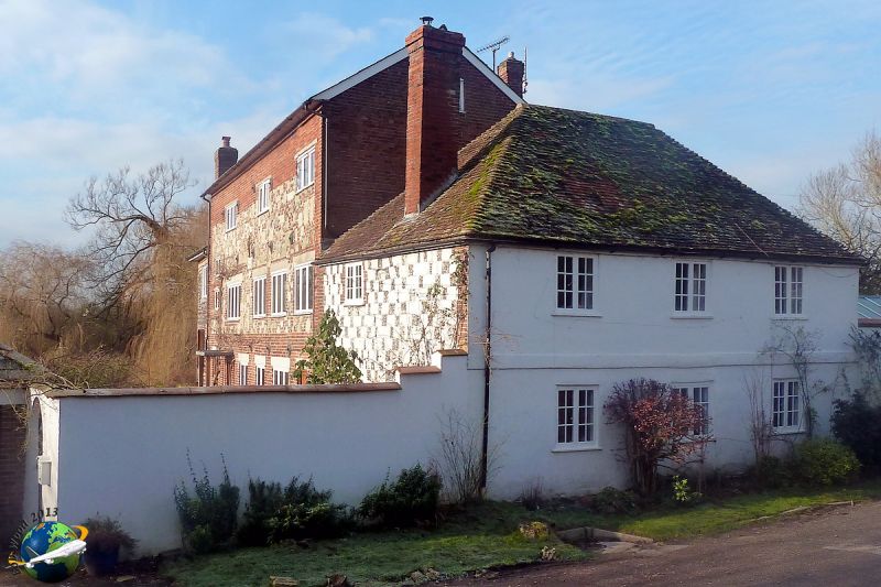
GV II Mill house, c1770. Flint and chalk chequerwork, rendered to front, tiled roof. Two storeys, 3 x 2 bays. Plat band. Entrance now in mill. Timber paned casement windows and one 9-paned sash to rear. Cogged eaves. Roof hipped and external gable stacks, that on north end partly demolished. To rear, the mill building, early C19. Dispersed brick and stone with slate roof. Two storeys, raised later to three. Three bays, with C20 full height extension on western end replacing leet. C20 windows. Culvert for millstream under building, with segmental arch. Much altered by recent windows and included for group value only.
Listing NGR: SU1577040807
External links are from the relevant listing authority and, where applicable, Wikidata. Wikidata IDs may be related buildings as well as this specific building. If you want to add or update a link, you will need to do so by editing the Wikidata entry.


Other nearby listed buildings